Contact Us

Use the form on the right to contact us.

You can edit the text in this area, and change where the contact form on the right submits to, by entering edit mode using the modes on the bottom right. 

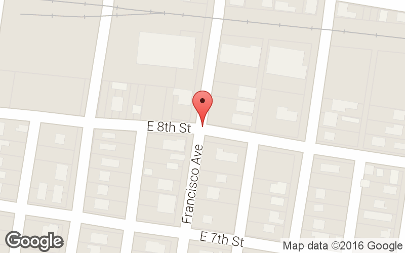
800 S. Francisco St.
Mission, TX
USA

Our website is all about motorcycles, especially BMW cycles. We cover rides in the Southwest and Mexico, motorcycle modifications and review motorcycle products. 

Big Bend National Pk.jpg

Ride Reviews

Filtering by Category: "BMW"

Labor Day Tour 2013

Tomas Perez

The bikes


I got up super early to pack the bike although our meeting time was 9 am. We left Mission at 9:15 am with temps already at 87 F. We are now at San Isidro for breakfast. Stats - 48 miles (ha), 52.2 avg mpg, temp 89 @ 10:30 am.
New gear on this trip for me is BMW Rallye Pro 2 jacket and pants and my 2nd ride with the Touring Pro boots. I even got a set of suspenders for my pants.  I plan to use them on the riding pants as well as my jeans.  Reviews on these to follow. 
Heading to Dilley and then Ingram. 


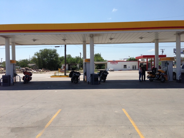
Fueling in Freer. 
Stats: temp 94F, 139 miles, 2.75 g, BC 51.1 mpg. 


With Ed, Hiram & Ricardo. 

About 20 miles south of Cotula it hit 100 F.  Cotulla is always hot. It was 101 in town. Dilley is just 18 miles north so we rode on. 


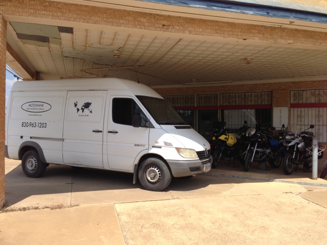
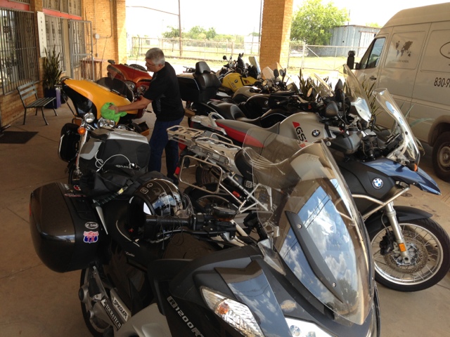
This is Motohank in Dilley, TX.  He's a pretty good BMW motorcycle mechanic. He can pickup and deliver in that MB diesel van in the picture. (Since Dilley is in the middle of nowhere)


Good mix of BMW bikes. 

The bike was finished shortly after 5 pm so we head north on I35 to Devine. At Devine we switch off from the Interstate to a nice country road - 173. We take 173 until Bandera where we stop for gas. 

Stats: Temp 99, miles 169, gas 3.4 gals, and BC claims 52.2 mpg. 

At Bandera we change over to highway 16 which is a very nice twisty road. We got to Ingram and my BC showed 61.9 mpg!  


Having dinner in Ingram. 

Nice easy first day with a total of 355 miles. Tomorrow we want to make it to New Mexico. 

2013/09/01
We pack, clean up the bikes and leave Ed's house at 8 am. Of course, we stop at 8:10 am for breakfast at the Hunter House Cafe in Ingrim.  It's only 10 minutes of riding but I could use some coffee.


We decided to take some back roads from Ingram to some point in New Mexico. We took 83 north to Eden where we got on 87 to San Angelo, on to Big Spring and then take 380 west at Brownfield. We take 380 to Roswell where we debate if we should continue north to Santa Fe in spite of rain and thunder showers.  It's already late but decide to do the run in the rain and darkness. The rain was not too bad. Get in rather late into Santa Fe. 

Total miles for Sunday was 995 (355 was on Sat). 

2013/09/02
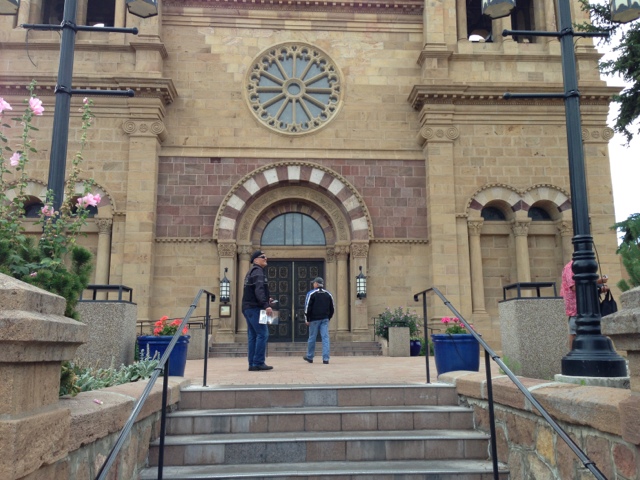
On Monday morning we ride to the square for some coffee and maybe something light for breakfast. 


We make several travel plans that we all break. We just kind of rode the local roads. First place we stop at is Chama, 

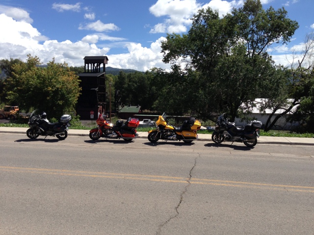
The bikes resting in Chama.

NM right next to the CO border. From there we head to Shiprock via highway 64 but when we get to 550 heading north we take that route in order to get away from the heat. At that time the high was in the low 90's. we make it into Durango, CO at about 4:30 pm. We rode 250 miles with the majority of that being in the mountains.  We decide to stay here for the night because we want to visit one of the local motorcycle dealers in the morning. 

Coffee in early morning Durango


[Let me interject at this point that the best intended plans can very easily fall by the wayside.  I stopped recording my fuel consumption because of a number of reasons.  It was already a little difficult having to document all the figures that I wanted to keep when others are waiting for you to depart.  A few of the problems that I had include stopping to fuel up during rain storms, a partial fuel stop at a very old place with very old pumps that I - for one - did not trust, and even a pump that did not take my card and two of us fueled up on one card swipe.  I decided to enjoy the ride and forget the stats.]

2013/09/03
After leaving the hotel in Durango we went to the Harley dealership there.  One of our guys wanted to add a few items to his baggage.  After our shopping we headed north via 550 to Silverton and then to Ouray for lunch.

Silverton down below
From Ouray we continue to Montrose and from there we use the minor roads and head north east to Carbondale.  From Carbondale we take 82 to Aspen.

I thought we would have to pay double our regular hotel rates in Aspen but we found a nice hotel at a very good price.  We got to Aspen in time for a few beers and dinner just before a storm hit the area.  The hotel manager even let us park the bikes under a car port after he moved his car out from his spot.  Nice of him to do that.

2013/09/04
First place we ride to is Maroon Bells just outside of Aspen.

Maroon Bells
We leave Maroon Bells and take 82 to Independence Pass.  That's always a nice ride.  This day it was just cool.  I've been here in June and still had snow and very cold weather.  I guess the weather changes.


Self explanatory
We then head north again to Rocky Mountain National Park.  The ride through that park is also recommended.  It has some awesome views and very easy to ride.

From there we head to Boulder for the night.

2013/09/05
From Boulder we decide to head back home to Texas.  We head to eastern Colorado (it's so different from the western part of the state) and head south.  As we head home the temperature just about doubles on us.  We don't get much of a chance to get acclimated to the near 100 degree weather.  Make it through Colorado, cut the handle of Oklahoma and into Texas to Lubbock.  I think the day total was 675 miles.  We did have a delay on the way to Texas.

Something on fire up ahead.
We had to wait for a while for that fire and finally they detoured us around that area.  All dirt roads.  They were ok to ride but of course very dusty especially with trucks also taking the detour.

2013/09/06
From Lubbock we take some strange back roads to Ingram.  I think our guide was lost because for many miles my GPS wanted me to turn around and distance to destination was increasing instead of decreasing.  But that's ok... the purpose of the trip was to ride.

We make it to Ingram in time to relax with some beer (again!) and watch a little TV.  No supper.  I don't know why we didn't get supper but we did finish all the beer.

2013/09/07
Our last leg is from Ingram to the Valley.  It's a short ride for a day.  We take our time taking back roads for the entire ride.  We have a few times when we run into rain.  Once we put on our rain gear only to have to take it off again about 20 miles down the road.  We're in south Texas now and it's about 100 F.  I even welcome small showers every so often.  It's like nature's air conditioning system.

The total miles logged on my bike for the trip was 3008 miles.  The other RT in the group had exactly the same mileage.  I liked the Rallye Pro 2 jacket and pants.  Also the suspenders make life a lot easier.

The cockpit 


The author and his RT
tsp

Riding The Storm

Tomas Perez

It has happened to everyone that has done any type of touring regardless of the season.  We all plan for it and if you have any experience with motorcycle touring you can read the signs and you have the equipment to handle almost anything nature can throw at you baring any major or catastrophic storms.  But in my case, I have no excuse.  I was caught unprepared for one of the worst rain storms that I have ever ridden through.

I had been visiting both of my local BMW dealers plus doing a little riding in the Texas Hill Country.  I use the term local rather loosely.  I wanted to take advantage of my ride to the dealer since it is 265 miles each way by extending my ride.  Dealer #2 is 327 miles each way but even more miles if I go via dealer #1.  A simple dealer visit is not a leisurely daily ride for many of us not living close to a major metropolitan area. It calls for a very long day of riding or a multi day trip.  Any day trip or longer and I pack for bad weather.  I always carry rain gear and in any weather other than the middle of Summer I will include some cold weather gear.

Looking back North towards the storm
 My wet weather riding gear consists of the following: Tourmaster Sentinel Rain Jacket, Olympia rain pants, Corbin seat cover, shower cap for XM radio, and BMW All Round gloves.  My current boots are BMW Touring Pro 2 (at times I also use Sidi Way boots) and they are totally waterproof.  My helmet is a Schuberth C3.  My head and feet are always covered (no pun intended) in case of rain.  More - both good and bad - on these two items later later on.  By the way, unless it's the middle of winter I use my BMW AirFlow 4 jacket for Texas riding.
(This Blog contains reviews on most of these items.)

During my visit to Lone Star BMW in Austin, Texas I purchased a Rev'It Wind Barrier jacket because a) it's very good and b) it was on sale.  I also purchased a cooling vest called Hyperkewl because a) it was hot as nearly always is in Texas and I was headed south where it's even hotter and b) it was relatively cheap at $39.95.  The sales lady kept telling me that she would soak the vest for me in the toilet for free as part of my purchase.  I soaked it in the sink in the men's restroom instead and left the dealer in the early afternoon.  The weather was hot but other than that it was very nice for a motorcycle ride.  In addition, I had called home and got a report of "it's sunny and a beautiful day".

Traveling through central Texas I almost always take back roads or secondary roads instead of the Interstates.  In this case I choose highway 123 and 72 to I 37 to I 59 for a short 8 mile run to 281.  I like highway 16 down the middle of south Texas brush country but not after dark.  That part of South Texas just has too many wild animals out after dark and even cows and horses seem to find their way out to the warmth of the road beds.  Once on 281 South I consider it smooth sailing for the last leg of my ride home.

Normally I'm OCD when it comes to riding or coming into bad weather.  Not to the point of stopping or outrunning a storm but more to preparing for the ride.  I tell my friends that I do not mind riding in cold weather nor rain (but not freezing rain!) since I have the gear for both including a bike that has excellent weather protection.  You learn to see the signs; dark clouds, oncoming traffic showing signs of rain or worse, any column of darkness from the clouds down to the ground are all signs that you are about to run into something big.  The column is a sure sign of rain or worse and the wider the column the larger the storm with little to no chance of riding out of it.

As I turn south on 281 in George West I see the columns.  Not one but two of them.  They appear to the east and west of my direction of travel but still a ways south of my position.  The thought comes into my head to stop at the DQ in George West to see what happens.  In any account I have not eaten lunch and it is mid afternoon.  I could use a meal and some caffeine.  But I decide to push on.

Within 10 or 15 miles I start to see little water droplets on my windshield.  They are so light that I don't even feel them on my helmet.  I ride through stuff like this often without doing any riding gear change.  This presents zero cause for alarm but there is a warning sign... I don't see the columns anymore.  I continue and it's only a few miles and I get a light shower but my only concern is my XM radio being exposed to water.  I think about my friend that says he does not put on rain gear in the summer and simply uses the opportunity to wash his riding jacket and sometimes riding pants.  I tell myself that I will wash the AirFlow jacket - it could use a cleaning anyway.  By this time I am in a heavy but otherwise normal rain.  I start my preparation.

Ok... I can do this.  Tuck in behind the fairing, raise windshield to just below eye sight, close helmet visor (make sure it's snug), and close both helmet vents (it matters).  It's important to close your visor before you get water on the inside and if you wear glasses you have another two surfaces that can get wet.  That's a total of four surfaces that can have water and limits your vision severely.  Add a windshield to that and you can consider yourself nearly blind if you continue riding.  But I'm good!  As a matter of fact only my arms are getting wet.  Even my radio, GPS and dash were only a little wet with slight spray.  I'm thinking: awesome bike, awesome fairing.  I'm actually enjoying the ride and keep in mind that I did not put on any of my rain gear.

And then it happened... I hit what appears to be a wall of rain... and high winds!  A little panic sets in plus sensory overload from the walls of water hitting me.  First thing that comes to mind is to pull over.  This is brush country and only a shoulder exists along the route.  In addition, stopping will result in a total soak within seconds but my main concern was for the bike.  The winds were too high and I thought that I would not be able to hold the bike upright during any sudden gusts.  I also was concerned about getting run over by some driver that could not see well which I knew was the case as that was happening to me.  Phase 2 kicked in right away.  First I lowered the windshield so as not to be kicked around so much by the winds and I turn on my 4 way flashers.  I have one car behind me and way ahead was an 18 wheeler that I no longer can see.  Not bad... the trailer has plenty of lights that are much more visible than car lights but at this point I don't see him ahead.  The car passes me up but within a mile he is slowing down to the point that I pass him.  While this is happening I feel my chest and legs get totally wet and then my crotch went from dry to wet within seconds.  I don't know why wet crotch feels like an insult when you are riding a motorcycle.  Your torso can dry and your legs can dry once you get out of a rain storm.  This is especially true in the Texas heat where a wet jacket can dry in minutes of riding.  But a wet crotch seems to stay wet forever and I always seem to get to the next gas stop and feeling like I wet my pants.

I can't see much but I see the trailer lights ahead.  At first I think that's good - something like my own personal lighthouse ahead of me but I find myself downshifting to 5th and then to 4th.  I'm shifting based on feel because I cannot read my gauges - not even the gear indicator.  I'm thinking this is too slow and thus dangerous and I could see where he was being pushed around by the winds.  I pull over to the passing lane with no indication of my intent because I have my 4 ways on.  I notice one of the reasons that he may have slowed down for was that there was a row of cars pulled over on to the shoulder.  I think about stopping myself but decide not to since the bike is handling the wind so well. I don't want to make this a BMW report but at this time I am gushing for the brand.  Since I saw columns before I hit the rain I figured that this was a storm within limited boundaries.  I continued for about 10 or 15 miles before the rain and wind let up to a normal shower.  The road ahead cleared up but I could not see any cars ahead of me.  Weird feeling being all alone on a highway that is normally busy.


Soon after the rain it was these things
 I stopped at a Whataburger in the next town so that I could take off my cool vest.  Didn't need it any more - as a matter of fact I felt cold.  Several people came up to me and advised me not to ride north.  Too late - would tell them I was just there.  When I told one man that I had just ridden through the storm he said "No way!  Otherwise your bike would be full of bugs.".  I didn't say anything but when he walked over to me and looked at the bike he apologized to me.  I guess because he was calling me a lair but I thought nothing of it.  I never found out how bad the storm was but part of Alice had no power, a gas station sign (the tall type) was blown over, entire crop fields were flooded and the Whataburger was full of cars.

I don't know how much of a lesson this was for me.  At my age, I mean experience, I should have known better.  Observations... I was impressed with my bike with the way it handled in such a storm.  And the other thing was that the only thing dry on me was my feet - totally dry!  I got home 2.5 hours later and I was still wet except for my feet.  The Rev'It jacket kept me warm even when my shirt and jacket were soaked.  I wore it under my AirFlow jacket.  I found it strange that I felt no cold yet my shirt was still very wet when I got home.  I was disappointed with my helmet.  In case you don't know it is expensive but it let in too much water.  In the past I've had a drop of water run down the front on the inside of the shield.  Then another drop and so on every few minutes while riding in a normal heavy rain.  On this ride I first felt a fine spray or mist inside the helmet (recall that I shut everything off before the heavy rain hit me but did not use the chin cover normally used in the winter).  Then the water droplets continued to get bigger to the point that I had as much water on the inside of the shield as I did on the outside.  Perhaps it was the wind forcing the rain in but it should not happen.  It's a safety issue IMO.  On a plus note I never got fogging inside the helmet.

My helmet didn't do much better

And what are these bugs that are out by the millions immediately following the rain?  They look like termites.  They are rather sticky since it was still raining when they start to come out yet don't get washed off the bike.  They would hit my helmet and stick and when I moved my head into the air stream to try to blow them off it only got worse with many more hits.

Thanks for reading,
tsp

Motorcycle Trip To Alpine, Texas & Big Bend National Park

Ricardo Perez

Big Bend National Park - Chisos Basin


The three days before Mother's Day four of us took a quick ride out to Big Bend National Park. Marco, Hiram, Tomas and myself left on Thursday morning about 5:45am under overcast skies with 80% chance of rain in the forecast. As we often do, we took the back roads way West with only us and a few thousand tractor trailers from the fracking fields cluttering up what were once lonely roads with great scenery. Now most of the highways are in terrible disrepair from the heavy tractor trailers going to and fro the fracking wells.
Dilley's under the center pin!
May 10, 2012 at 11:45am
Hank From Motohank Dilley, Texas
We headed northwest first toward http://www.motohank.com (Motohank's) so that Marco could get a new set of tires on his BMW RT. Hank owns the shop and he's a certified BMW motorcycle mechanic in Dilley, Texas. You'd think that he wouldn't have any business out in the middle of nowhere, but he's got a healthy clientle from both the Rio Grande Valley and San Antonio. Dilley is approximately 85 miles North of Laredo on I35 and 75 miles from San Antonio. It's approximately 230 miles from Mission, TX.
About an hour before we hit Dilley it started to rain and soon thereafter we rode into a heavy shower. It rained most of the way into Dilley, but as we approached Dilley there was a cloud off to our West side that was so dark that it looked dark green instead of just black. As both cloud and riders raced toward Dilley it became obvious that the cloud won by a mere five miles or so. It really started raining hard, but it was no time to pull over as we knew we were close to Hank's shop. Again my waterproof BMW Motorad All Around gloves with the rubber visor wiper on the forefinger were a life saver. I was on my 2008 Harley Ultra Classic while Tomas and Marco were on their 2010 BMW RTs and Hiram on his BMW GS. My bike started to miss badly as water was sucked into the air intake, but I was able to make into Hank's covered garage area. It wasn't five minutes after we reached Hank's that quarter size hail started to fall. The whole scene was bleak, dark, wet and windy. We were just grateful we had made it safely and knew that we weren't about to rush off as Hank began the tire replacement on Marco's RT.

Sanderson After Thunderstorm
We moved on from Dilley about 1pm headed Northwest toward Uvalde and then West on Hwy 90 to Brackettville. Brackettville is home to the movie set "The Alamo" filmed in 1960 starring John Wayne as Davy Crockett. From there we continued West to Del Rio where we stopped at Rudy's BBQ for a late lunch. By the time we left Rudy's it was starting to rain again. We flew by Langtry and rode into Sanderson for fuel before moving on to Alpine. The rain finally started to clear up in Sanderson and dark skies began giving way to some sunlight.We rolled into Alpine about 8:20 in the evening still with our rain gear on, but it had stopped raining most of the way between Sanderson and Alpine. We met up with a rider on a BMW GS from Houston named Andy. He rode into Alpine about three hours ahead of us and asked if we ran into the hail before Sanderson. We hadn't, but Andy said that it covered the highway for about 300 yards or so approximately ten miles before entering Sanderson. Thinking he was just seeing a water reflection on the highway he rode into a layer of hail between an inch or two thick. Andy said he'd figure he was going to lose the bike, but managed to keep it upright and slow down in order to slowly pass through it.
Alpine Best Western
Friday morning Andy was headed out to Terlingua to camp out a couple of nights, but we mentioned that camping at the Chisos Basin within Big Bend National Park was a lot better than Terlingua.
 We spent the morning in Alpine before riding about 82 miles South on Highway 87 down to Study Butte and Terlingua. Study Butte and Terlingua are at an elevation of 2,582 feet so its sometimes really hot especially around July. Compared to Alpine at 4,500 feet and the Chisos Basin in Big Bend at 5,400 to 5,700 feet which are much cooler Terlingua is usually very warm. It's an interesting area with its share of interesting people much like Marfa with its art community.
Study Butte
After a short rest we entered Big Bend National Park from the West entry which lies just a couple of miles outside of Study Butte. Unlike the North entrance, the Western entrance is more stark and moonlike looking with weird rock formations that don't look like they can support much life, especially not livestock.  A few miles further into the park is the lone entry booth and this time it was actually open with a female Ranger charging an entry fee. That's kind of rare, seeing anyone in that booth since its about 26 miles from Panther Junction where the Park Headquarters is located. I flashed out my senior pass and driver's license and went right in. We headed to the Chisos Basin 30 miles away at the posted speed limit of 45mph.
We rode around the basin campsites and picked out one with a nice flat area which would hold our three tents. It was within about 25 yards from the host park ranger (a volunteer position). We quickly made friends as we introduced ourselves. As it turns out, the Ranger, Rick Trimble a retired school teacher from Plano High School District. He was orginally from our neck of the woods, La Feria in the Rio Grande Valley; small world. We also met up with Andy, our friend from back at the Best Western in Alpine. Andy joined us for dinner at the Basin Cafeteria where we each had a few Shiner Bocks and we took two bottles of wine back to the campsite. Andy and Rick joined us as we enjoyed our wine, the sunset and just general chat about riding and camping out. It was one of those times where you say, "it doesn't get better than this!". As Andy and Rick retired for the evening we just stood out by the tents looking at the millions of stars that we just can't see from the city.
We were up at daybreak and breaking down camp as we readied ourselves to leave after one quick night at the park.
We rode out about 8am and headed north exiting the North entrance and making our way to Marathon about 80 miles from the basin. We had breakfast at the Coffee Shop on the West side of the Gage Hotel (I have a blog piece on the Gage Hotel). Coffee and breakfast was great as we sat outdoors next to a group of birders trying to imitate the Great Horned Owl. I tried to help out with the Three Amigos bird call, "loook...up...here.....loook...up...here". They didn't get it.
Entry From Western Side
We had to make up some time in order to get back for Mother's Day so we rode hard without any lengthy stop until we made it to Hebbronville where we stopped at the local Dairy Queen. We rode up on Thursday logging in approximately 678 miles, only about 120 miles on Friday and another 650 or so on Saturday. It was too short a time, but a great ride. Can't wait to do it again!


Our Campsite at the Basin
Casa Grande at base our our camp area


Marco and Hiram 

Big Bend National View

View at Cafeteria 


There's a View at Every Angle

Marco & Hiram


View Larger Map

Galeana Mexico via Motorcycle

Ricardo Perez

Galeana Church
Galeana is a medium sized city located in the state of Nuevo Leon and about 200 kilometers south of Monterrey. It’s a neat little community, high up on the Sierra Madre Oriental at an elevation of 5,430 feet. This is the same mountain range that runs along the Northeast Mexico and up through Big Bend National Park in Texas.

Going Up Towards Galeana
 Galeana is a small town nestled among the mountains just southwest of Linares and Montemorelos. We took our motorcycle route through Reynosa, Mexico and then made our way down the autopista to General Bravo. From there we jumped off the main highway and headed to China then General Teran. Motemorelos, famous for its citrus industry was next on the way and finally Linares before making our way to Galeana. Its a short distance in total, about 220 miles, but it takes a good five hours plus to finally make it there. The countryside is beautiful once you pass Linares as you begin to climb towards Galeana which lies at approximately 5,500 feet. Aramberri and Doctor Arroyo are further to the south with Iturbide to the east. 
My LT BMW
Galeana is one of those small towns that's a jewel to visit. It's got great weather, small enough to where everybody is very friendly, and it's so conveniently close to the United States that it's easily a great weekend ride. That is, once the violence down there ends and its once again safe to travel. So my Mexico ride stories have become rides that we've taken in the past. What a shame that we can't ride into Mexico right now without the fear of getting assaulted, but like all things, I believe that this will pass and touring Mexico will once again be safe. Can't wait since it's such a beautiful and historic country.


View Galeana, Mexico in a larger map
Leaving Galeana


Heading Towards Galeana


Dinner Time
View From Plaza

Long Line of Riders


BBQ: Motorcycle Ride to Texas Pride in Adkins, Texas

Ricardo Perez

Texas Pride BBQ in Adkins, Texas

Saturday was a cool cloudy day and perfect for a nice day ride. We rode out at 6am for breakfast in San Isidrio and from there we kept going north on Hwy 16 just before Loop 1604 in San Antonio and then headed east around Loop 1604 to Adkins, Texas which is between I10 East (Houston) and Hwy 87. Texas Pride http://www.texaspridebbq.net is a nostalgic trip in time if you're of age to remember things from the 50's or so. In the 60's I worked at a Sinclair gasoline wholesale distributer so it was neat to see all the old Sinclair signs and gas pumps.
Old Gas Pump & Coke Machine
Most the pumps read between 19 Cents and 24 Cents per gallon.

Sinclair Dino
Aside from all the antiques the BBQ is really good. We each had some type of Monster Sandwich for $8, two toasted buns loaded with pork ribs without the bone and brisket. Looked like about 3/4 of a pound of meat which can easily be shared by two. The sandwich and a large tea cost $11.02 which is pricy, but you get a lot of sandwich for that price. The guy behind the counter said that there's an even bigger sandwich, but we didn't go there. That same guy mentioned that we should drop by on Thursday,  bike night. According to him there's over 500 bikers every Thursday. They have live music in the pavilion area behind the restaurant as well as a special parking area for motorcycles and a motorcycle shop. The shop was closed, but it looks like they sell lots of after market stuff. It's worth a return trip just to check it out.
Motorcycle Shop
After lunch we slowly made it back to the valley via Karnes City and Kenedy. Kenedy, like most rural towns in Southwest and West Texas is overrun by oil riggers working on Oil Fracking. Seems like each small town from Hebbronville, to Freer, Jourdanton, Kenedy, and everything in-between is overrun by big Tractor Trailers loaded with pipes or other oil drilling rigs. That means lots of mud on parts of the highway. Temporary RV parks just pop up over night and it seems like each little town has a hotel or motel under construction. So towns like Kenedy no longer just have prisons as their major industry, now its prisons and rough necking.
We spent about 15 minutes in Kenedy talking with a guy that had a Kawasaki motorcycle made up to look like an Indian Motorcycle. He was really proud of it and mentioned that he had owned it all of three hours.
We rode approximately 520 miles on a beautiful cloudy day with temps in the high 60s and 70s. A great ride with great BBQ. 

Ed, Tomas, Hiram at Texas Pride BBQ


View Texas Pride BBQ in a larger map

Honda ST Motorcycle Cheap STOC Rally: Camp Wood, Texas

Ricardo Perez


View Larger Map
Intersection of Hwy 83 & 337 in Leakey Texas

The annual Honda ST rider's Cheap STOC (ST Owner's Club) Rally was held May 6-8 in Camp Wood, Texas. That's right, May 8th was Mother's Day, but that didn't seem to bother anyone very much. They must have been abused children? Tomas, Marco, Ed and I rode up on Thursday from Mission/Edinburg and going by way of Boerne. Marco had a service scheduled for 9:30am at the Alamo BMW Motorcycle dealer. We left Mission at 4:30am and Edinburg by 5:00am. Marco went ahead of us once we stopped for coffee in Falfurrias, but we met up about 11am at the dealership. We were off to Camp Wood via Bandera, Medina, Vanderpool. and Leakey by 3pm and arrived by 5:30pm. We stopped in Leakey at  Hogpen BBQ right on the intersection of Hwy 83 & 337.
Ed's pretending to read at Lost Maples Restaurant

Keith, Man in Black is wanted in several counties


Restaurant 

 some of us had just ridden the Three Sisters (Hwy 335, 336, & 337) we decided to do something different so we rode to Utopia via 337, 83 and 1050 for breakfast at the Lost Maples Restaurant Cafe.
We met these guys at our motel. Cycling from San Diego to Austin averaging approximately 60 miles per day

From there we headed south on 187 to Sabinal then west on 90 through Uvalde and into Brackettville, about 30 miles east of Del Rio. Brackettville is home to the Alamo remake which was used for the movie by John Wayne. It's open for tourists if you're into that kind of thing.

Stuart Bat Cave At Kickapoo Cavern State Park
Brackettville was our destination in order to get to Hwy 674 to Rocksprings. It's one of my favorite road which doesn't get much use. It's about 60 miles from Brackettville to Rocksprings and it's a great ride. About halfway up 674 is the Kickapoo Cavern State Park which is about a two mile ride onto the State Park Road. It's also about as little known as Hwy 674, but worth the time to visit.
Last summer the countryside on this highway was really green, but this time around with our drought conditions, it was rather dry, but the stark contrast made it a very nice ride.
Feed the Trough BBQ in Rocksprings
Once we got to Rocksprings we decided to stop at Feed the Trough BBQ. It was late afternoon and they were just taking the beef right off the grill. Don't know how it tasted since we stuck to the Root Beer Floats as we had planned an "all you can eat" catfish dinner back in Camp Wood. Mistake!
Back in Camp Wood we had a good, but not great catfish dinner then gathered around the motel with the rest of the ST Cheap STOC folks. We had a very good rain storm roll in about 9pm and enjoyed seeing some rainfall for a change.
We left Camp Wood in the morning and I headed back home via Hwy 83 and Tomas, Ed, and Marco headed back to the BMW dealer in Boerne for their open house and the first viewing of the BMW K1600 GTL motorcycle. It's the new six cylinder motorcycle that's replacing the four cylinder LT. I owned a 2005 LT and it always seemed a little top heavy at parking lot speeds, but this new bike is suppose to have a much lower center of gravity and a dream to handle. We'll see in the future if that holds to be true. We'll have to make our way back to Alamo BMW for a test ride and another report. At-a-glance the bike looks great, sounds great, and has a seating height that allows someone like me at 5'10" with a 31" inseam to be flat footed on the ground.

The New BMW K1600 GTL

West Texas On Fire - Motorcycle Ride in West Texas

Ricardo Perez


`
Wildfire View from Sanderson's Desert Air Motel

I had to run up to Alpine to give a presentation on a new insurance package to our TRLA Alpine Office, but after the first question I had to use my "call a friend life line" to our Benefits Director. After that call I just held the posters and as Julie said, I was in my best Vanna White mode. An exhausting presentation.
Tomas and I had started out early from Mission stopping in San Isidro for breakfast where we were warned not to stop for any suspicious looking police/deputy/DPS vehicles because there's been a rash of robberies by men pretending to be cops. Just like the Zetas in Mexico. Good to know that there's nothing like having a little bit of Mexico in South Texas to make the ride more interesting!
We've been in a drought throughout Texas and the valley had not had significant rainfall since late July 2010 so when we saw the thunderstorm approaching us north of Hebbronville we were glad to see rain clouds. That good feeling didn't last too long as we had to pull over about 20 miles south of Freer, pull out the rain gear and move on. I have a BMW one piece rain suit that I brag about being absolutely water proof and the perfect outfit for any thunderstorm. I was wrong. The rain really started falling and the wind was blowing the rain sideways and soon I began to feel rain coming up my sleeves because I forgot to put on my neat rain gloves, the ones with the little squeegee on the forefinger for wiping the water off my face shield. Those gloves overlap the rain suit sleeve, my summer riding gloves don't do that and with no place to pull off the highway it was too late to change. Then I felt water dripping down my neck onto my shirt and rain coming up my pant legs so by the time we made the Love's Truck Stop in Encinal some 70 miles later, I was soaked. A guy who passed us up on the way to Encinal was also at Love's and came over to tell us that he couldn't believe we were riding in that rain and that he wouldn't do it for any amount of money. It's hard to look like "mancho man" when you're soaking wet so we just smiled and said it cooled us off. I switched shirts, fueled up and rode on. The clouds were gone past Encinal and 30 miles later I was totally dry.
Riding in the rain, if you stay dry, is not bad especially in summer months when it's a nice cooling off break. The only scary part, apart from hitting water puddles and fearing hydroplaning (not a good thing on two wheels) is lightening. Before getting to Freer there were some pretty nasty flashes that were a little too close for comfort. I can feel myself ducking as we cruise by those big radio antennas. I'm thinking that the rubber tires prevent grounding with the pavement so I should be okay, right?
There's not too much change in the landscape from the valley and the rest of South Texas not until we pass Eagle Pass, about 20 miles west on Hwy 277 do things change as we approach Quemado, Texas. Quemado is a small town sitting in what is a beautiful oasis of green pastures and huge pecan groves. There isn't anything like it east or west for hundreds of miles. It's by the Rio Grande River with its pastures and groves irrigated by a series of canals. It's worth the time to get off the highway and take the narrow two lane county road which parallels the river for a few miles.
Another 36 miles to Del Rio, stopped at Rudy's BBQ for a late lunch before continuing on Hwy 90 west to Alpine from Del Rio. We're running late so there's no time to stop at the Pecos River overview of the highest suspended bridge in Texas or at Judge Roy Bean's Museum in Langtry as we kept rolling west.
West Texas Fires - photo by JBalovich
We fueled up in Sanderson, Texas and had been on the road all day with 455 miles behind us and only 84 to go on Hwy 90 before reaching Alpine, Texas. As we rolled into Sanderson the setting sun silhouetted what I thought was a beautiful rain cloud finally making their way into dry, drought stricken West Texas. Between that beautiful cloud and our bikes sat on the middle of our lane two Sheriff Deputy vehicles with their red and blue lights flooding the highway. No doubt some type of license check point or a search for poachers. I was wrong. As I pulled up to them they said the road was closed because there was too much smoke across the highway. That's when I realized my beautiful rain cloud was actually smoke from the burning fires. The deputies said that the wind usually dies down at night so the highway might open by 1am or we could head north to Fort Stockson on Hwy 285 and then south on Hwy 385 to Marathon, a 120 mile detour. The wait would be too long and riding at night is never a safe alternative in deer country so we checked in at Sanderson's Desert Air Motel for the night. The $48 room charge convinced me that stopping overnight was a smart move.
Still burning by Hwy 90 West of Sanderson

West of Sanderson fires rule. With the highway now open I left the motel at 7am leaving Tomas to get some more sleep. Highway 90 west to Marathon was open, but it was still burning just off the highway and with the winds picking up again during the day the highway would close again by that afternoon.

Friday morning and the fires are still burning. This is how much of the area looks like now.

Late Friday morning Tomas joined me in Alpine and we headed south to Study Butte before entering Big Bend National Park. The skies were still hazy as far south as the park. At the Chisos Basin we met a fellow rider on a Ducati riding from Phoenix, Arizona to Houston. He had been riding since Tuesday (four days) and heading east. I mentioned that unlike his ride from Phoenix we were just down the road about 600 miles and then it dawned on me that we were about the same distance from each other. On the way north we were at the speed limit of 75mph when suddenly a very huge buck stood in front of me on the middle of the highway. I slammed on the brakes, but he just looked at me like I was invading his space. He walked off, leaped a fence and disappeared into the woods. To say he jumped the fence would be wrong, implying that effort was involved, and with a graceful walk he glided over the fence as if it were only a foot high.


We left Big Bend by way of the North entrance coming out in Marathon planning to head east to Sanderson for a second night's stay. Unfortunately, Hwy 90 was again closed so we rode back into Marathon to try and find a room for the night. Alpine was booked, and so was Marathon. We had no choice, but to go north about 60 miles on Hwy 285 to Fort Stockton. We landed a room at the Hampton Inn. We rode about 340 miles on Friday before we finally ending up in Fort Stockton.
About 10pm Fire Fighters started coming in for the night. Seems all were young, looking like America's real cowboys, beat and weary from fighting fires. They all carried their packs with everything from sleeping rolls to work boots. By 6am they were eating breakfast and gone by 6:15am. These young men and women had to be worn by the daily grind of coming in late at night and leaving before daylight.
West Texas blazes. Photo by JBalovich
Saturday morning we were off at 8:15am riding to Eagle Pass, Freer, Hebbronville and home. We rode 534 miles on Saturday and 1,335 miles in three days.
It was impressive to see the charred landscapes looking stark and strange like something from another planet. Rain will certainly help put out the fires and restore the landscape to its natural beauty. Until that comes about it's worth your time to see parts of West Texas in this unusual setting.


View Larger Map

The Three Sisters Hill Country Motorcycle Ride

Ricardo Perez

Luckenbach Store Front
For our first real ride in April my wife and I rode along with Albert and Lisa Chapa to the hill country to ride the popular Three Sisters. We left Mission on Thursday about 9:30am and rode on the Expressway 83/281 about 20 miles to Susie's a small restaurant just past the Flying J and before Love's truck stops. It's a tiny restaurant with good breakfast plates.
By the time we rolled out from Susie's it was about 11am, but we were in no hurry since our ride that day was the destination. We stopped twice, at the rest stop in Falfurrias and then at the rest stop past Three Rivers before heading into Pleasanton then west to Jourdanton to gas up. North of Jourdanton we took Hwy 173 to Hondo then Bandera and Medina on old highway 16. Nine miles north of Medina is the Koyote Ranch RV and Resort where we stayed for three nights and four days.
Koyote Ranch is an out-of-way place with a restaurant, store, an outdoor stage with a live band on Saturday nights as well as neat little cabins next to the general RV lots. The particular weekend we were there was also an annual bike rally for gay women and the place was packed so there was good live music and interesting bikes! We stayed in some of the cabins that can sleep up to six or so, but we each had our own cabin with a neat rear patio deck, great for just sitting and drinking some cold beer.
Our first day's ride totaled approximately 330 miles so we had plenty of time to just kickback and enjoy the rest of the afternoon and evening.
One of my favorite bikes at the museum.
Vanderpool, Texas

Friday we rode into Medina for breakfast then get on Hwy 337, the first of the Three Sisters Highways, riding west towards Vanderpool. In Vanderpool we made the ritual stop at the Lone Star Motorcycle Museum. I've been to the museum at least half a dozen times, but it was Albert and Lisa's first visit and I always like to stop there. You've got to support somebody that's crazy enough to put a motorcycle museum in the middle of nowhere! Of course, we  checked out the vintage bikes and enjoy some nice bench time before continuing west on 337.
Next stop was Leakey which has a nice big gas station now on the south side of town as well as a good outdoor BBQ & Beer joint right on the northwest corner of the Hwy 83 and 337 intersection. We fueled up in Leakey then continued west on 337 to Camp Wood for an early lunch. Camp Wood is most famous for Charles Lindbergh. He landed there in 1924, three years before his historic trans-atlantic flight, and crashed into a local store trying to takeoff. He had to spend a week or more there while parts arrived to repair his damaged Jenny.
From Camp Wood we headed north on Hwy 335 for the second leg of the Three Sisters. Being further west and because of the ongoing drought the ride on 335 showed just how dry things are this spring with no rain. Twenty eight miles north Hwy 41 intersects 335 so a quick 10-15 mile ride east on 41 and you're at the Hwy 336 intersection. Headed south on 336 for 27 miles and although you can't see it most of the time, we are riding parallel the Frio River all the way back in Leakey. This time we stop for a cool beer before heading back east on 337 to Medina and then Koyote Ranch. This was Friday and it was a great day of riding and we got to ride the famous Three Sisters, Highways 335, 336, and 337.
Friday afternoon we were joined by my brother, Tomas, and Ed Ramirez and late that same night Marco Gutierrez rode in from Edinburg. Saturday morning the seven of us rode north on old Hwy 16 into Kerrville for breakfast. Old Hwy 16 north of Medina is a very scenic hill ride that has several low water crossings as well as two hairpin turns. It's another must on anybody's riding list. After breakfast Tomas and Marco split off and headed to a BMW rally in Llano while the rest of us rode to Fredericksburg for a couple of hours before heading to Albert, Texas. Albert is much like Luckenbach, but without the people. It's got a dance hall and two huge oak trees which are the hallmark of Albert. It's worth the ride if you like out of the way places without the crowd you find in Luckenbach.  From Albert we headed towards Blanco then Luckenbach. Since it was Saturday afternoon a live band was performing. The music was great, but too many people so we headed back to Kerrville for some BBQ before attending mass at the local Catholic church. We rode into Koyote at dusk and settled in for a quiet night of listening to the live band from our cabin balcony.
Sunday morning and time to head back home. After breakfast in Hondo we made our way back to the valley via Hwy 16 through Tilden, Freer, Hebbronville, La Gloria, McCook and back to Mission. A great four days of riding with good friends, nothing better!
View Larger Map
View Larger Map

Touring & Culture in South Texas via Motorcycle Riding

Tomas Perez


There are times in my day that are totally wasted by sitting around and thinking of an excuse to go ride. For example, yesterday I had planned to run an errand that took me to the town west of my hometown. Before I had a chance to set out on my errand I got a call from my son asking me if I could go check a problem with the AC unit in one of his businesses that is located to the east of my hometown. I decided I better do my part in conserving energy (gasoline in this case) and take my motorcycle instead of my of my cars. That's all the excuse I needed.

It was the new business opening last week that provided another excuse to take a longer ride to a little known attraction that is located about 80 miles to the north of Mission. I decided to visit the shrine of Don Pedro Jaramillo in the town of Falfurrias, TX. Don Pedro was a curandero or faith healer in south Texas around the turn of the century.


Being the middle of March the day was quite windy but one of the advantages that I have noticed on current touring motorcycles is that they offer such good wind and weather protection while remaining very stable regardless of wind direction. It's not as exciting to discuss as horsepower, top speed, or acceleration but I think these company spend millions of dollars studying the dynamics of cross winds on both the motorcycle and the rider. My current ride continues to amaze me in how well it handles in high cross winds.

I left my house and took the back roads to a connecting point to north bound highway 281. That short ride gave me a chance to get my riding legs ready for the trip before hitting highway speeds. I glanced at the fuel level and wondered if it was enough to do the 80 mile one way ride as it showed a little more than half a tank. I hit the trip computer button to see the remaining range and see that the computer is showing about 180 miles! It must be that high since I am crusing at about 55 mph where mileage is about the highest it can get (excluding rolling down a hill or mountain - been there, done that). The bike always does well over 50 mpg when I don't ride faster than about 70 mph and even at 70 mph I get about 50 mpg assuming no high head wind. Anyway, at 180 miles I'm good to go.

Once I'm on highway 281 riding due north I force myself not to use the cruise control until I am out of the valley and see far less traffic on the road. This is the first bike I've ever had that has a true cruise control. I now wonder how I functioned without one for so many years. About 15 miles north of Edinburg I get lazy and switch the cruise control on at 70 mph - the legal speed limit. The GPS shows 67 mph so I tap the cruise increase button twice and my true speed is now 70 mph. For good measure I tap it 3 more times and I am now cruising at an indicated speed of 78 or a true speed of 75 mph. At this speed my speedometer reads about 3 mph faster than true speed. My mind always factors this in when I set speeds. The time is now nearly 3PM and I want to make sure I get to the shrine before the little local store next to it closes for the day. What I need is an item that is sold in that store.

Don Pedrito Jaramillo died in 1907 but he had many followers and other people that believed in him. He was buried in Falfurrias in a ranch cemetery. Some time after his burial a shrine was built over his grave.


Don Pedro's grave is located in this corner of the shrine.


The second photo (below) shows the many photographs that people have attached to the walls of the shine either requesting help or claiming that they were helped or healed by a prior visit.


After talking to the lady that runs the store for nearly an hour I loaded up the bike so that I can head back into town about 4 miles away. Fuel level was still good but I wanted to top off before heading back home. I top off the tank with an additional 4.96 gallons. That means I had at least 1.6 gallons left in the tank. A funny thing about an RT gas tank is that it is really a 7.1 gallon tank that BMW downgraded to 6.6 gallons by putting a filler tube part of the way into the tank. This forces you not to fill the tank to the very top (unless you stand there and keep nursing a little more gas at a time as you fill above the bottom of the filler tube). Some riders have even been known to remove the tube from their bikes! If those BMW engineers only knew what they are doing to their bike...

I stopped doing that... takes too much time and besides it splashes little drops of gasoline around the top of the tank and that really bothers someone that is OCD about their bikes. You see - being on the road you can't simple wash the area well with car washing soap and water, polish the area again, and finally apply a good 2 or 3 coats of wax. And if you want to do the job right you should remove the tank bag rails. That's not too bad... remove the seats and 4 Torx screws and you're set to really clean that area under the rail. Well... you get my point.

Anyway, in my opinion BMW added this filler tube on the remote chance that you would 1) put the bike on the center stand and fill it to the very top of the gas tank neck on a really cold day and then 2) roll or ride the bike a very short distance and park it on the side stand, and 3) the day heats up a lot and the gasoline expands overfilling the tank getting into charcoal canisters, spilling on the ground, blown into catalytic converters, blab, blab, blab. Disclaimer - I'm just kidding here! No hate mail! Remember - I'm OCD about this thing!

Back to the gas station. I reset my odometers, turn on my GPS (don't know why - I've taken this road about a hundred times), tune in my XM and point the bike due south. Two miles and I'm out of town so it's cruise control time again. Time to sit back, listen to the sounds (review on this soon), and enjoy the ride home. The temperature is dropping under 80 making for a perfect ride home.

Oh... almost forgot. This is what I purchased for my son's new business.


I guess the modern aspect to this is that the candles are in English and Spanish. In my discussions with the lady she told me to wash them just in case someone else had touched them, light them and let them burn, and if they went out or got black that it was a bad sign. I washed them when I got home.

Keep the rubber on the road,
tsp


Mt. Evans via Motorcycle: Highest Paved Road in North America

Ricardo Perez


Echo Lake
I'll admit I'm afraid of heights and even though riding to the top of Mt. Evans Scenic Byway was a real rush it's not something I'd like to do again! In a four wheel drive vehicle it would be great, but it will still have you holding your breath on some of those hairpin turns. It's something I'm glad I've accomplished, but it was never on my bucket list of must things to do. Mt. Evans lies west of Denver and its narrow road, without guard rails and with dramatic drop offs and snow covered sides lays claim to being the highest paved road in the North America.
Our ride started in the Rio Grande Valley of South Texas in June at 5:30 am on a typical day in South Texas, a perfect morning soon to get hot. There were five of us riding, Marco Gutierrez a local physician who lives in Edinburg riding a BMW GS, his brother David who flew in from Florida and had his Yamaha at Marco's house ready to ride, Ed Ramirez a computer programmer at the University of Texas at Pan American from Alamo on his 2010 Harley Davidson, my brother Tomas Perez on a Honda ST 1300 and myself riding my 2008 HD Ultra Classic. We decided to avoid the major highways on our trip to Colorado by riding along the less frequently traveled roads or what we call the back way to West Texas. It's a lot quicker ride if you stay on the interstates, Highway 281/37 to San Antonio then I10 West with speed limits at 80 west of Kerrville. Our more pedestrian route first took us to Hebbronville on Hwy 1017 via McCook and San Isidro. From Hebbronville we took Hwy 16 North to Freer before turning northwest on Hwy 44 to Encinal then north on Hwy 83 to Carrizzo Springs and on to Del Rio, 300 plus miles from Mission. It was lunch time and we stopped to eat at Rudy's BBQ.
West of Del Rio is the Pecos River and Langtry, home to Judge Roy Bean, Law West of the Pecos fame. The bridge crossing the Pecos is the highest suspended bridge in Texas and it crosses the Pecos right before it merges with the Rio Grande River. We stopped at the Overview park to check out the view of the Pecos River, the bridge and off at a distance to the South the Rio Grande River.
Pecos River
It was over 100 degrees in Langtry, so we stopped at the very nicely built Texas Department of Transportation (TxDot) Travel Information Center. It's home to the historic saloon of Judge Roy Bean and just about every publication at the center is free including complimentary copies of Ride Texas Magazine. Langtry is like an oasis in the desert so it's worth the stop.
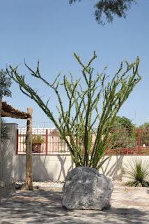
TxDot Information Center
On the road again, its now hot enough to make you think about how great tires are that they can roll mile after mile on pavement that's got to be at least 115 degrees without melting. You don't think about that in a car, but it sure crosses your mind on a motorcycle. Being partial to a tire manufacturer dedicated to motorcycle tires, I run with Metzeler and like their grip in the rain. We continued west along Hwy 90 to Sanderson, a town with two noteworthy gas stations. There's a popular big gas stop at the western end of town and on the east end of town a small gas station with a shaded picnic table that makes for a good soda break. I'm not sure why Sanderson is out there, maybe because of the intersection on Highway 285? It's this highway which we took as we headed 65 miles northwest to Fort Stockton. Fort Stockton is on I10W so it gets traffic running between El Paso and San Antonio especially truck traffic. We crossed Fort Stockton still headed northwest toward Pecos, another 55 mile jog. Pecos is usually very hot and dry, but we were lucky to hit a thunderstorm as we rode into town. The welcome rain cools us off for the rest of the day. Pecos is not suited to handle much rain and the streets were quick to flood. We weren't far from the Land of Enchantment, New Mexico so we pushed on. It was getting late in the afternoon so temperatures started to cool off as we entered New Mexico. There's a dramatic drop in speed limits going from Texas to New Mexico from 75mph to about 60mph. That's pretty unbearable on roads with little or no traffic so we ride at a conservative 73mph as the GPS reads. We rode past Carlsbad as the sun set and stopped for the first night close to Lakewood at a local KOA Campground. It was a good first day's ride, approximately 742 miles, and ready for dinner.
KOA Camp North of Carlsbad, NM

Day two was a much cooler day. We took some back roads toward Roswell where we stopped for breakfast at Denny's. Western New Mexico is fairly flat and the winds can really blow. We rode through some strong cross winds and luckily squeaked through threatening thunderstorm clouds that made the storms back in Pecos look like a spring shower. Traveling northwest we stopped for a couple of hours in downtown Santa Fe. We had a light lunch at the French Pastry Shop & Creperie by the plaza. They have great pastries and good coffee, a must stop if you're in the area.
Downtown Santa Fe near French Pastry Shop

We continued our ride through Santa Fe and headed north toward Pagosa Springs, CO and the San Juan National Forest. Cross into Colorado and the landscape turns emerald green a sharp contrast from the desert sands of West Texas and New Mexico. From Pagosa Springs we headed west to Durango and ending our second riding day. We had crossed the entire state of New Mexico, an easy 500 mile day compared to our first day's ride.
Close to Pagosa Springs, Colorado

Durango, Colorado is home to the Narrow Gauge Railroad that runs between that town and Silverton. It's a popular ride and one I had taken many years ago when my kids were younger. The scenic ride meanders through the mountain passes to Silverton.
Silverton, CO
Silverton, the only scheduled stop, offers enough time for shopping and lunch before heading back to Durango.
We stayed at the Holiday Inn Express and got a late start because I wanted to wait for the local Harley Davidson shop to open so I could buy a heated vest. Seems I packed long sleeve shirts, but not nearly enough warm clothes for the upcoming days. We would experience temperatures as low as 36 degrees on our trip, a dramatic difference from the weather in Langtry! Finally, late that morning we rode west to Mesa Verde National Park. The cliff dwellings of the Pueblo people date back to 600AD and it's good ride. The terrain flatten out as you go west and things warm up a bit.
Mesa Verde National Park
We backtracked to Durango and headed north to Silverton then Ouray.
Ouray is known to some winter tourists that visit us in South Texas as the little Switzerland of the USA. Having never been in Switzerland I have no clue as to the truth of that statement. Ouray is nestled between some fairly big mountains leaving you the sensation of being in a bowl.
We continued north to Montrose, but decided to double-back south to find Ridgway State Park near Ridgway where we wanted to camp for the night.
Ouray the little Swiss Town
We pitched our tents, made a fire, and chatted into the night before getting into our sleeping bags. It was 46 degrees that night so our sleeping bags were perfect for a cool night. I've always camped with our Marmot sleeping bags rated at 30 degrees and our Comet two person tent from Sierra Designs. The Comet has extra strength poles for those windy nights. Both of these come from REI online orders.
Ridgway State Park is rated as one of the top ten state parks in the United States. If you walk to the top of a small hill there's a beautiful view of an adjoining lake. We had two campsites, but decided to group our three tents on one site and got in trouble for that. We used one site to park the bikes and another to camp, but park rules limit the number of tents to two per site. Who knew?
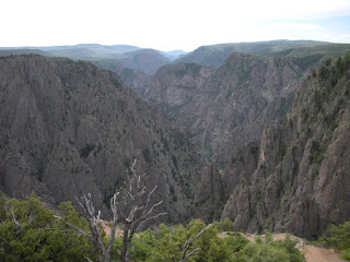
Black Canyon
Marco Gutierrez at Black Canyon
The Park Rangers at Ridway State Park, yes, the same ones that got after us for too many tents on one site were very good in offering us travel recommendations. They recommended we stop at the Black Canyon mentioning that most people don't even realize its there and its often overlooked even though its a great place to visit. We took their advice and headed in that direction. We had an early brunch in Montrose before heading to the Black Canyon of the Gunnison National Park then back on the road headed east toward Gunnison.
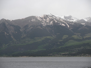
Riding into those mountains as we head to Aspen
We rode Hwy 50 east to Poncha Springs then north on 285 to Buena Vista. North of Buena Vista we caught Hwy 82 and headed northwest to Aspen. Highway 82 is a narrow two lane road that eventually makes its way to Aspen. The weather was overcast and threading to rain, but we made it safely to Aspen. After walking some of the downtown streets in Aspen we decided that it's not for us so we ride on.
Next came Carbondale then Glenwood Springs before getting on I70E and headed to Vail. We stopped for the night at one of the many hotels on I70.
The next morning we continued on I70E headed for the base city of Mount Evans, Idaho Springs which is about 45 minutes west of Denver. Idaho Springs was a welcome site, unlike Aspen or Vail, this town had regular stores and restaurants and just regular working class people. We had been on I70 with typical traffic congestion, but still a beautiful ride as expressways go. After a short break in Idaho Springs we started on Hwy 103 to Echo Lake. Echo Lake has a nice gift shop and restaurant and I don't know if its best to stop there on the way up or on the way down, but I would recommend making that stop on the way down. Weather changes can be sudden and dramatic especially in the late afternoons so it's best to get the ride out of the way before it gets too late. On the way down the Echo Lake stop seems like you're safe again, so stop and get those bumper stickers that say you made it to the top of Mt. Evans. On the way up those decals seem expense, but on the way down they seem like a real bargain.
We started our climb about noon with clear skies. It had been in the 70s down at Idaho Springs, but it was now getting cooler. Just beyond the Echo Lake stop is the official park entrance. An entry fee of about $10 is required. The park road is very different than the highway leading up to Echo Lake. It's much more narrow and the tall forest trees are much closer to the road than down below. The road has a steady climb, the terrain slowly giving way to less trees and suddenly you are above the tree line. Being scared of heights made me tighten the grip on my handlebars, focus on the road and not on the sheer drop-off just a few feet away, and a fixation on my Garmin GPS's altitude gauge. I knew that the switch-backs would end at 14,130 feet so I kept glancing at the GPS wondering if it was really right. The switch-backs literally make 180 degree turns. Keeping the bike upright as you navigate each turn was a challenge. The altitude displaying on my GPS was moving fast, but to me it seemed too slow for me. After every turn around the bend there was more road in front of us, always leading up. Eventually we could see the lookout building and knew we were making it all the way to the top. The temperature was now between 36 and 39 degrees. It was difficult to breath and my heart was really pumping. I think its natural to breath more rapidly to get more oxygen in your lungs. I was wrong and realized that when I read the informational sign telling you to stay calm.
View from top of the highest paved road in North America!
Knowing what lay before us, the ride back down the mountain was very welcome. We could relax and enjoy the view knowing that every turn got us back closer to planet earth.
Once we were back at Idaho Springs we made our way West on I70 and turned north on Highway 40 heading to Grandby. We took the Trail Ridge Road 34 across the Rocky Mountain National Park to Estes Park. The Trail Ridge Road was another high altitude adventure as we crossed the Continental Divide again on our crisscrossing ride in Colorado. Of course, this road was tame compared to the Mt. Evans adventure and the inclines on the cobblestone roads of Real de Catorce in Mexico. Rocky Mountain National Park gets over three million visitors a year and I can understand why as you travel the Ridge Road you will see wildlife like huge elk, green meadows in panoramic views below your road elevation, and snow in the summer. Estes Park is another great park that serves as the East entrance to the national park. It makes for a great camp base before heading into the national park.
We spent our last night in Colorado on the outskirts of Boulder and so ended our rocky mountain ride. We headed out of Colorado via Hwy I70E across the eastern part of Colorado. As we headed east we made Salina in Kansas then south to Wichita and pressed on to Oklahoma City. It was a long day's ride logging over 700 miles. The next day we duplicated our miles by doing another 700 plus mile ride home from Oklahoma City to Mission, Texas. By the time we hit the Texas state line we were back in hot weather and our heavy jackets and electric vests were somewhere deep in our saddle bags by then.
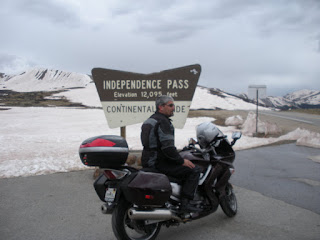
David Gutierrez at Independence Pass - 12,095 Feet

Road leading to summit
We rode over 3,200 miles on our trip and crossed West Texas, New Mexico, Colorado, Kansas, Oklahoma and Texas again, but north to south. We averaged about 500 miles a day at speeds between 80 and 5mph. We weathered temperature changes from 100 degrees to close to freezing, crossed the Continental Divide, camped out, visited several National Parks and got to see the great outdoors.
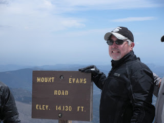
Yep, we're at 14,130 feet!

Tomas, Ed, David, & Marco


Marco Gutierrez, David Gutierrez, Tomas Perez, Ricardo Perez, Ed Ramirez
Summit 14,130'


View Mt. Evans Colorado in a larger map
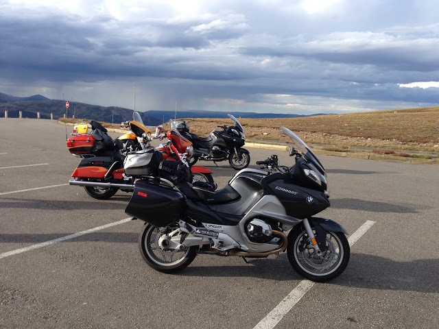
The Gage Hotel in Marathon & Riding Big Bend Via Motorcycle

Ricardo Perez

Our room at the Gage.
My 2005 BMW LT
Marathon is a small community north of Big Bend National Park, divided by the railroad, trains run just about on an hourly schedule, round the clock. If trains bother you keep riding another 32 miles west to Alpine. Aside from the Austin influence that's taking over some of the real estate and raising prices it is still a great place to visit before heading into Big Bend National Park.  This is especially true if it's late in the afternoon since chances are you will not get a good campsite at the Chisos Basin (that's the place to camp) so I'd recommend staying at the historic Gage Hotel in Marathon, Texas for at least one night. All campsites at Big Bend except for those at the Chisos basin are probably too hot if its after May so check-in at the Gage and get an early start to the basin. Marathon is about 45 miles north of the park entrance and another 20 plus to the park headquarters and finally another 10 to the basin.
The Gage Hotel, built in 1928, has two sections, one being the old historic section and the newer ground level rooms near the pool and an outdoor panel. If you're a history buff stay at the main building, if you want to kick back in the patio and drink some refreshments then go for the newer section.
The Gage also has a nice bar and a good restaurant, but it's pricy and something we usually avoid.
Once in Marathon there are few good places to eat and just to walk around and see. There's an old cemetery across the tracks and just a few miles away are the remains of Fort Pena Colorado which protected settlers from Indians. It was settled in 1879 and closed in 1893.
Downtown Marathon at sunset
rap & irma

An alternative to the Gage is the Marathon Motel & RV Park just west of the Gage. It not as fancy, but it has a great outdoor patio and fire place.  You're free to start up a fire in the fire place and settle back into a lawn chair.

There is a great view of the Glass mountains to the north and east as well as the Santiago mountains to the south and southwest. It has small cabins which are not as nice as the rooms at the Gage. Of course, this is the place to stay if you're pulling an RV.  They will also let you setup a tent if you want to camp out on their grounds. Both locations are great and it's best to call ahead for reservations.
Marathon RV & Motel Patio Area


View Marathon, Texas in a larger map

Laguna Atascosa National Wildlife Refuge on Motorcycle

Ricardo Perez


Laguna looking north up the bay!
Last weekend (March 2011) we took a short ride, 186 miles total, to and from Laguna Atascosa National Wildlife Refuge. It's fairly well hidden and accessible only on a very poorly maintained road especially the last seven miles or so. Parts of the road seem to have washed away and you've got to slow down to about 15mph.  Once in the park there's a 14 mile or so loop around the entire refuge.  The Spanish explorer Alonzo Alvarez de Pineda hit this area around 1519 and it looks probably much like it did then, but look across the bay and it's 2011 with South Padre Island on the horizon's view.  The refuge is mostly dense brush which serves as habitat to a large number of wildlife.  Road signs warn of crossing wildlife, but none in sight on a late afternoon except for an exceptional view of birds both on and off shore. If you don't like big crowds this a perfect place to visit.  Here's the LANWR website:  http://southwest.fws.gov/refuges/texas/STRC/laguna/Index_Laguna.html

Laguna tower and bikes!
SPI in the distance directly across the bay.
Sunset on the West side of Refuge.
From the scenic overview tower South Padre Island is visible across the bay. As a matter of fact you can see Port Isabel, the causeway, and SPI. It's a spectacular view and judging from the little traffic it's a view few people get to see. Ed Ramirez, Tomas Perez and I rode together and stayed through sunset before heading back home.