Contact Us

Use the form on the right to contact us.

You can edit the text in this area, and change where the contact form on the right submits to, by entering edit mode using the modes on the bottom right. 

800 S. Francisco St.
Mission, TX
USA

Our website is all about motorcycles, especially BMW cycles. We cover rides in the Southwest and Mexico, motorcycle modifications and review motorcycle products. 

Big Bend National Pk.jpg

Ride Reviews

Filtering by Category: "Harley Davidson"

Labor Day Tour 2013

Tomas Perez

The bikes


I got up super early to pack the bike although our meeting time was 9 am. We left Mission at 9:15 am with temps already at 87 F. We are now at San Isidro for breakfast. Stats - 48 miles (ha), 52.2 avg mpg, temp 89 @ 10:30 am.
New gear on this trip for me is BMW Rallye Pro 2 jacket and pants and my 2nd ride with the Touring Pro boots. I even got a set of suspenders for my pants.  I plan to use them on the riding pants as well as my jeans.  Reviews on these to follow. 
Heading to Dilley and then Ingram. 


Fueling in Freer. 
Stats: temp 94F, 139 miles, 2.75 g, BC 51.1 mpg. 


With Ed, Hiram & Ricardo. 

About 20 miles south of Cotula it hit 100 F.  Cotulla is always hot. It was 101 in town. Dilley is just 18 miles north so we rode on. 


This is Motohank in Dilley, TX.  He's a pretty good BMW motorcycle mechanic. He can pickup and deliver in that MB diesel van in the picture. (Since Dilley is in the middle of nowhere)


Good mix of BMW bikes. 

The bike was finished shortly after 5 pm so we head north on I35 to Devine. At Devine we switch off from the Interstate to a nice country road - 173. We take 173 until Bandera where we stop for gas. 

Stats: Temp 99, miles 169, gas 3.4 gals, and BC claims 52.2 mpg. 

At Bandera we change over to highway 16 which is a very nice twisty road. We got to Ingram and my BC showed 61.9 mpg!  


Having dinner in Ingram. 

Nice easy first day with a total of 355 miles. Tomorrow we want to make it to New Mexico. 

2013/09/01
We pack, clean up the bikes and leave Ed's house at 8 am. Of course, we stop at 8:10 am for breakfast at the Hunter House Cafe in Ingrim.  It's only 10 minutes of riding but I could use some coffee.


We decided to take some back roads from Ingram to some point in New Mexico. We took 83 north to Eden where we got on 87 to San Angelo, on to Big Spring and then take 380 west at Brownfield. We take 380 to Roswell where we debate if we should continue north to Santa Fe in spite of rain and thunder showers.  It's already late but decide to do the run in the rain and darkness. The rain was not too bad. Get in rather late into Santa Fe. 

Total miles for Sunday was 995 (355 was on Sat). 

2013/09/02
On Monday morning we ride to the square for some coffee and maybe something light for breakfast. 


We make several travel plans that we all break. We just kind of rode the local roads. First place we stop at is Chama, 

The bikes resting in Chama.

NM right next to the CO border. From there we head to Shiprock via highway 64 but when we get to 550 heading north we take that route in order to get away from the heat. At that time the high was in the low 90's. we make it into Durango, CO at about 4:30 pm. We rode 250 miles with the majority of that being in the mountains.  We decide to stay here for the night because we want to visit one of the local motorcycle dealers in the morning. 

Coffee in early morning Durango


[Let me interject at this point that the best intended plans can very easily fall by the wayside.  I stopped recording my fuel consumption because of a number of reasons.  It was already a little difficult having to document all the figures that I wanted to keep when others are waiting for you to depart.  A few of the problems that I had include stopping to fuel up during rain storms, a partial fuel stop at a very old place with very old pumps that I - for one - did not trust, and even a pump that did not take my card and two of us fueled up on one card swipe.  I decided to enjoy the ride and forget the stats.]

2013/09/03
After leaving the hotel in Durango we went to the Harley dealership there.  One of our guys wanted to add a few items to his baggage.  After our shopping we headed north via 550 to Silverton and then to Ouray for lunch.

Silverton down below
From Ouray we continue to Montrose and from there we use the minor roads and head north east to Carbondale.  From Carbondale we take 82 to Aspen.

I thought we would have to pay double our regular hotel rates in Aspen but we found a nice hotel at a very good price.  We got to Aspen in time for a few beers and dinner just before a storm hit the area.  The hotel manager even let us park the bikes under a car port after he moved his car out from his spot.  Nice of him to do that.

2013/09/04
First place we ride to is Maroon Bells just outside of Aspen.

Maroon Bells
We leave Maroon Bells and take 82 to Independence Pass.  That's always a nice ride.  This day it was just cool.  I've been here in June and still had snow and very cold weather.  I guess the weather changes.


Self explanatory
We then head north again to Rocky Mountain National Park.  The ride through that park is also recommended.  It has some awesome views and very easy to ride.

From there we head to Boulder for the night.

2013/09/05
From Boulder we decide to head back home to Texas.  We head to eastern Colorado (it's so different from the western part of the state) and head south.  As we head home the temperature just about doubles on us.  We don't get much of a chance to get acclimated to the near 100 degree weather.  Make it through Colorado, cut the handle of Oklahoma and into Texas to Lubbock.  I think the day total was 675 miles.  We did have a delay on the way to Texas.

Something on fire up ahead.
We had to wait for a while for that fire and finally they detoured us around that area.  All dirt roads.  They were ok to ride but of course very dusty especially with trucks also taking the detour.

2013/09/06
From Lubbock we take some strange back roads to Ingram.  I think our guide was lost because for many miles my GPS wanted me to turn around and distance to destination was increasing instead of decreasing.  But that's ok... the purpose of the trip was to ride.

We make it to Ingram in time to relax with some beer (again!) and watch a little TV.  No supper.  I don't know why we didn't get supper but we did finish all the beer.

2013/09/07
Our last leg is from Ingram to the Valley.  It's a short ride for a day.  We take our time taking back roads for the entire ride.  We have a few times when we run into rain.  Once we put on our rain gear only to have to take it off again about 20 miles down the road.  We're in south Texas now and it's about 100 F.  I even welcome small showers every so often.  It's like nature's air conditioning system.

The total miles logged on my bike for the trip was 3008 miles.  The other RT in the group had exactly the same mileage.  I liked the Rallye Pro 2 jacket and pants.  Also the suspenders make life a lot easier.

The cockpit 


The author and his RT
tsp

Motorcycle Trip To Alpine, Texas & Big Bend National Park

Ricardo Perez

Big Bend National Park - Chisos Basin


The three days before Mother's Day four of us took a quick ride out to Big Bend National Park. Marco, Hiram, Tomas and myself left on Thursday morning about 5:45am under overcast skies with 80% chance of rain in the forecast. As we often do, we took the back roads way West with only us and a few thousand tractor trailers from the fracking fields cluttering up what were once lonely roads with great scenery. Now most of the highways are in terrible disrepair from the heavy tractor trailers going to and fro the fracking wells.
Dilley's under the center pin!
May 10, 2012 at 11:45am
Hank From Motohank Dilley, Texas
We headed northwest first toward http://www.motohank.com (Motohank's) so that Marco could get a new set of tires on his BMW RT. Hank owns the shop and he's a certified BMW motorcycle mechanic in Dilley, Texas. You'd think that he wouldn't have any business out in the middle of nowhere, but he's got a healthy clientle from both the Rio Grande Valley and San Antonio. Dilley is approximately 85 miles North of Laredo on I35 and 75 miles from San Antonio. It's approximately 230 miles from Mission, TX.
About an hour before we hit Dilley it started to rain and soon thereafter we rode into a heavy shower. It rained most of the way into Dilley, but as we approached Dilley there was a cloud off to our West side that was so dark that it looked dark green instead of just black. As both cloud and riders raced toward Dilley it became obvious that the cloud won by a mere five miles or so. It really started raining hard, but it was no time to pull over as we knew we were close to Hank's shop. Again my waterproof BMW Motorad All Around gloves with the rubber visor wiper on the forefinger were a life saver. I was on my 2008 Harley Ultra Classic while Tomas and Marco were on their 2010 BMW RTs and Hiram on his BMW GS. My bike started to miss badly as water was sucked into the air intake, but I was able to make into Hank's covered garage area. It wasn't five minutes after we reached Hank's that quarter size hail started to fall. The whole scene was bleak, dark, wet and windy. We were just grateful we had made it safely and knew that we weren't about to rush off as Hank began the tire replacement on Marco's RT.

Sanderson After Thunderstorm
We moved on from Dilley about 1pm headed Northwest toward Uvalde and then West on Hwy 90 to Brackettville. Brackettville is home to the movie set "The Alamo" filmed in 1960 starring John Wayne as Davy Crockett. From there we continued West to Del Rio where we stopped at Rudy's BBQ for a late lunch. By the time we left Rudy's it was starting to rain again. We flew by Langtry and rode into Sanderson for fuel before moving on to Alpine. The rain finally started to clear up in Sanderson and dark skies began giving way to some sunlight.We rolled into Alpine about 8:20 in the evening still with our rain gear on, but it had stopped raining most of the way between Sanderson and Alpine. We met up with a rider on a BMW GS from Houston named Andy. He rode into Alpine about three hours ahead of us and asked if we ran into the hail before Sanderson. We hadn't, but Andy said that it covered the highway for about 300 yards or so approximately ten miles before entering Sanderson. Thinking he was just seeing a water reflection on the highway he rode into a layer of hail between an inch or two thick. Andy said he'd figure he was going to lose the bike, but managed to keep it upright and slow down in order to slowly pass through it.
Alpine Best Western
Friday morning Andy was headed out to Terlingua to camp out a couple of nights, but we mentioned that camping at the Chisos Basin within Big Bend National Park was a lot better than Terlingua.
 We spent the morning in Alpine before riding about 82 miles South on Highway 87 down to Study Butte and Terlingua. Study Butte and Terlingua are at an elevation of 2,582 feet so its sometimes really hot especially around July. Compared to Alpine at 4,500 feet and the Chisos Basin in Big Bend at 5,400 to 5,700 feet which are much cooler Terlingua is usually very warm. It's an interesting area with its share of interesting people much like Marfa with its art community.
Study Butte
After a short rest we entered Big Bend National Park from the West entry which lies just a couple of miles outside of Study Butte. Unlike the North entrance, the Western entrance is more stark and moonlike looking with weird rock formations that don't look like they can support much life, especially not livestock.  A few miles further into the park is the lone entry booth and this time it was actually open with a female Ranger charging an entry fee. That's kind of rare, seeing anyone in that booth since its about 26 miles from Panther Junction where the Park Headquarters is located. I flashed out my senior pass and driver's license and went right in. We headed to the Chisos Basin 30 miles away at the posted speed limit of 45mph.
We rode around the basin campsites and picked out one with a nice flat area which would hold our three tents. It was within about 25 yards from the host park ranger (a volunteer position). We quickly made friends as we introduced ourselves. As it turns out, the Ranger, Rick Trimble a retired school teacher from Plano High School District. He was orginally from our neck of the woods, La Feria in the Rio Grande Valley; small world. We also met up with Andy, our friend from back at the Best Western in Alpine. Andy joined us for dinner at the Basin Cafeteria where we each had a few Shiner Bocks and we took two bottles of wine back to the campsite. Andy and Rick joined us as we enjoyed our wine, the sunset and just general chat about riding and camping out. It was one of those times where you say, "it doesn't get better than this!". As Andy and Rick retired for the evening we just stood out by the tents looking at the millions of stars that we just can't see from the city.
We were up at daybreak and breaking down camp as we readied ourselves to leave after one quick night at the park.
We rode out about 8am and headed north exiting the North entrance and making our way to Marathon about 80 miles from the basin. We had breakfast at the Coffee Shop on the West side of the Gage Hotel (I have a blog piece on the Gage Hotel). Coffee and breakfast was great as we sat outdoors next to a group of birders trying to imitate the Great Horned Owl. I tried to help out with the Three Amigos bird call, "loook...up...here.....loook...up...here". They didn't get it.
Entry From Western Side
We had to make up some time in order to get back for Mother's Day so we rode hard without any lengthy stop until we made it to Hebbronville where we stopped at the local Dairy Queen. We rode up on Thursday logging in approximately 678 miles, only about 120 miles on Friday and another 650 or so on Saturday. It was too short a time, but a great ride. Can't wait to do it again!


Our Campsite at the Basin
Casa Grande at base our our camp area


Marco and Hiram 

Big Bend National View

View at Cafeteria 


There's a View at Every Angle

Marco & Hiram


View Larger Map

Sturgis Motorcycle Trip

Ricardo Perez

Harley Dealership in Sturgis

My Toy Hauler & F350
Back in 2008 I owned a Toy Hauler fifth wheel trailer and used it to trailer my bike and a friend's bike up to South Dakota. We started in Mission, Texas and went up through the panhandle and into Colorado then Nebraska and South Dakota. My Toy Hauler was a 37' Keystone Raptor which I pulled with a Ford F350 diesel. Pulling that much weight was never a problem, stopping on a dime was another story. There was so much "mass" behind you that it could easily push you if you weren't careful. I never really had trouble handling it, but you had to pay attention to under-passes since it required about a 13' 6" clearance. Turning tight corners was another thing you had to watch out for. I once ran over a curb in Eagle Pass while pulling over to decide where to eat (letting my stomach do the thinking instead of my head) and the tire popped like a ballon. Fortunately, we were only about a half mile from a truck stop where they called a guy to remove and replace the tire. That incident starting me thinking about replacing the Toy Hauler with something I can maintain myself. It was obvious that changing a tire is no simple task when trying to jack-up a 15,000lb unit. Turning a fifth wheel is much easier than turning a tow-behind unit and you can surprise yourself with a little practice how tight a turn-around you can maneuver on a fifth wheel. Regardless, the Toy Hauler is a beast  and you can't get too confident pulling that unit down the highway.
We left Mission, Texas early in the morning joined by another couple from Pharr, Texas and quickly made our way past San Antonio and on to I10 West. We then turned Northwest and headed to Fredericksburg then San Angelo. We kept going until we were north of Lubbock and stopped for the night at an RV Park. It was past 10pm by then and we had been on the road over 14 hours. We moved out early and headed through the Oklahoma panhandle and into Colorado. We ended our second day in the late afternoon at the Sterling State Park. The park was fairly deserted and we had most of the park to ourselves.
Sterling State Park - Colorado
Rainbow's End
Once out of Eastern Colorado the countryside started to get more interesting, everything was green, much different than the type of landscape we have in South Texas. We went into Rapid City then ran uphill into Nemo, a small village in the hills about 20 miles from Sturgis.  We stayed at Big Moma's place which is a horse ranch most of the year except during Sturgis' Bike Rally when she converts the place into an RV and Camping ground. We arrived the week before the rally in order to ride across Wyoming and camp out at Yellowstone National Park. The camp ground was really great. We had pick of any spot since we were there early so we backed up our RV close to the stream running behind us and about a hundred yards from the highway. We had a couple of friends join us, one from Minnesota and the other from Wisconsin. They joined us in Nemo and camped out a few hundred yards from where we parked the RV. We unloaded the bikes and made ourselves at home for a couple of days before heading out to Wyoming and Yellowstone National Park.
Creek by our Toy Hauler
Once we got back from our ride to Yellowstone we made time to join up with some other friends for some nice riding. Our first day we rode to Mt. Rushmore and rode through the Needles and through Custer State Park. We also made it to the Crazy Horse monument. We made time to stop by some good lunch spots and had a good time.
The next couple of days we would ride in to Sturgis to check out all the sites including all the different bike vendors although we didn't spend any money on all the available add-ons. Back in Nemo we spent the evening planning our BBQ menu and having a few refreshing brews as we sat around and enjoyed the nearby creek, the high cliff beyond the creek and passing motorcycles. Big Moma's had a bar setup at one end of the pasture which made it nice once we ran out of beer and their live music meant we didn't have to worry about finding our own.

We ventured into Deadwood one morning to check it out and ended up at a restaurant that was also a bar and casino. The slot machines were already going as we sat down for breakfast, but we didn't waste our money on any gambling. Deadwood was founded in 1876 after gold was discovered in the Black Hills in 1874. The town was famous for its outlaws and gamblers. Wild Bill Hickok was shot in a saloon with the famous "Dead Man's Hand" of aces and eights. Wild Bill Hickok and Calamity Jane are both buried in Deadwood.  We walked around Deadwood for a while before heading out to the Interstate.
Sturgis, South Dakota is home to the largest or second largest motorcycle rally in the world. It's always held the first full week in August. We had been out to Yellowstone National Park during our first week and spent the second week in our Raptor in Nemo. Nemo is relatively higher elevation than Sturgis so its cooler and certainly lots less crowded. It's about 20 miles from Sturgis so it was a quick 20 minute ride into the rally. Our first trip into Sturgis was one of those where you just follow the other bikers hoping someone knows where they're headed. As it happened, we ended up parked by the local Harley dealership and in the middle of everything. What's best about Sturgis is that there are so many vendors that you get to at least see products closeup, where you can grab them and check them out. That's a treat compared to the blind purchasing done on the internet.
Of course, there's lots of demos as well and bars with live music. They must bring in police from throughout the state because they are everywhere and there's no drinking on public sidewalks, streets, or public places so those that happen to walk out of a bar with a beer got zapped fairly quickly. That was rare since most places had someone at the door to remind patrons that you couldn't take that beer with you. As for food, we mostly stuck to the vendors selling whatever verses eating inside a restaurant. Restaurant food was okay, but nothing to write home about.
In all, I think we went into Sturgis only twice since once you've seen it, it doesn't much change. We had a much nicer time back in Nemo with our friends, our BBQ, beer, and music. It was so relaxing that we didn't miss all the buzz down at Sturgis.
All in all, the rally and just the fact that we were in a state where everything was green and cool compared to the 100 degree weather in South Texas made this a special trip. We got to see our friends who joined us at Big Moma's and met their friends from different states. That made 10 of us riding around and enjoying each other's company and the great countryside as well as the rally in Sturgis. Every rider should make that trip a least once in their lifetime.

Sitting by Toy Hauler: Checking email and enjoying a couple of beers!

Jaime, Ricardo, & Mike pointing up to the cliff beyond the pasture.

Friendly Man in Deadwood
View of Mount Rushmore as we exit a tunnel
Deadwood Store
Stream Running Through Big Mama's Pasture


Passing Through Roswell New Mexico

At Santa Fe Plaza - Birthday Girl


We're checking out some on the spot pin striping work.

Irma's Taking a Break at Sturgis

She better watch those hot pipes!


George wasn't saying much!


In the Needles as we approach a 360 turn!

Where to Now?

The Needles

One of many one lane tunnels

Here's the Gang at Crazy Horse Monument 

Crazy Horse

Low Clouds Approaching

Entering Hill City

He wanted to tattoo Irma

Take a Tequila Shot or get bounced!

Sturgis Bar

Where's My Bike?

Hey, another Chicano!

She was on Letterman that week!

Sturgis

Irma

Ricardo

Fishnets still in style?

Local Bar

After many miles we get back to Texas!
Ricardo and Irma in Sturgis


View Larger Map

Lone Star Motorcycle Rally Galveston Texas

Ricardo Perez

The Strand - Galveston's Main Street

Our Riding Buddies From Corpus Christi


The Lone Star Rally gets really crowded, but the best part is that it allows us in South Texas just about the most coastline riding you can get, especially north of Corpus Christi, Texas. It's slow going, but a nice ride to the seaside town of historic Galveston.
Once you're at the Rally there's tons of bikes so finding a spot to rest your bike can be a challenge. We stayed in Kemah which is about 20 miles from Galveston since we couldn't find a place in Galveston, but as it turned out, that was a good thing. It's peaceful and lots of things to see in Kemah so it's a nice break from all the crowds in Galveston. Our hotel was right by the docks in Kemah and some nice sea food restaurants.
At the Rally we had a good time just seeing everything that's out on the Strand. We also went into the Convention Center to see the displays, but that was definitely a waste of money (seen one, you've seen them all) imho.
The ride north of Corpus was great as we went through Rockport, Port Lavaca, Palacios, and then along the seashore from Free Port into Galveston. We ran into some rain, but it was warm so it was a welcome site although rain in Galveston's Strand makes riding your bike hazardous since the rail line running down the middle of the road gets slick as ice when it's wet. We saw a few bikes go down as they tried to cross it running parallel to the tracks.
So next time you make this rally be sure and take time to go down the coast to Free Port then make your way up to Angleton home of GOE Harley Davidson. It's one of those small town local dealers that's family owned so they're friendly and a great place to visit. GOE Harley Davidson

Of course, last, but not least are the great little sea food restaurants all along the coast line between Galveston and Corpus. Take time to get off the road in these small towns and check out their great food.


Need a Parking Spot!

Plenty of Bikes to See
View From Hotel

View Larger Map

San Miguel de Allende Motorcycle Ride

Ricardo Perez


San Miguel de Allende

Our trip in 2006 to San Miguel de Allende was one of the best riding trips we ever took into Mexico.
We met in Pharr, Texas on Hwy 281 just north of the international bridge from Reynosa, Tamaulipas, Mexico.  It was almost exactly a year since our last trip into Mexico when we rode down to Real de Catorce, San Luis Potosi, Mexico on a short four day ride.  Real de Catorce was at one point in time the richest silver mining town in the western hemisphere and now is a quaint tourist village whose only entrance is a one lane mile long tunnel.


 Word spread about the good time we had the year before and our original group of 15 was now 28 with 18 bikes (with an additional couple joining us in Cd. Valles).  It was the second week in March, coinciding with Texas schools’ spring break. 

Lou, Bruce, Bob
My wife and I awoke about 3am to finish packing and to make sure we were in Pharr, about 20 miles from our house in Mission, on time.  I had plenty of time to pack the bike, check everything, and recheck.  We made Pharr right at 6am.  There were already about six riders there, mostly the group that came down from Corpus Christi, but within twenty minutes everyone showed up.  Seems we weren’t the only ones who couldn’t sleep! 

Lunch Time
     After we all topped-off our tanks, said a group prayer, and had our last cup of coffee we headed out at about 6:45am, still dark, across the international bridge into Mexico.  The weather was a very nice 72 degrees or so.  We rode through Reynosa’s eastside and out of town headed towards the coast then south on toward San Fernando and then Cd. Victoria.    Eighteen motorcycles meandering through small Mexican villages and twisty mountain roads made the going slow, but we were able to coordinate all our stops on a pretty orderly basis and after the first few times it didn’t take long for us to line up for gas at all the available pumps at the nationalized PeMex stations and move through the refueling process fairly quickly. 

As we got close to Cd. Victoria we shot off the main road to a small local restaurant for some good carne guisada (braised beef tips).  It was good home food cooking because it was both a restaurant and residence.  After lunch we rode through the outskirts of Cd. Victoria and on to Cd. Mantes. 

Hotel Taninul in Cd. Valles
Ready To Ride
     Gradually, the terrain began to change from the typical south Texas semi-arid desert to green semi-tropical surroundings.  It got hot towards the end of that first day, well into the 90’s as we entered Cd. Valles.  We stopped in Valles for the first night and stayed at a resort hotel named Hotel Taninul http://www.taninulhotel.com on the outskirts of town which is famous for its springs.  The hotel staff was very accommodating, asking us to park our bikes under their entry veranda.  For most of us, this was our first experience of traveling together in such a large group, but by natural instinct everyone went about their way, some straight to the bar, others to check in, and still others to eat.  We couldn’t help notice that the hotel had a weird type of smell, not offensive, but not typical of anything.  Well, we soon found out that the smell was caused by the high concentration of sulfur in the spring waters that ran right through the hotel.  Cd. Valles gets many visitors who come to dip in the sulfur springs, long known as a therapeutic cure for body ailments.  A few also discovered the metallurgic properties of sulfur on silver.  It turns silver black, but as we later discovered on our trip it can be reversed. 

     Early the next morning we all had breakfast and were joined by a couple from Tampico who would lead us on our next leg, across the mountains toward San Miguel de Allende.  We left the hotel at 9am and it wasn’t very long before our semi-tropical surroundings really switched to a much more tropical look.  Everything was a beautiful green and plants and trees were already blooming into beautiful colors.  It also was sugar cane harvest time and we would come up on slow moving trucks loaded to several times their height with sugar cane.  Needless to say, we ran over a lot of sugar cane which fell from these trucks. 

Tropical Highway as we head up mountains
     At first we traveled on mostly beautiful rolling hills and through green pastures.  As we rode, you could see off in the distance the silhouette of low hanging clouds which slowly transformed into a mountain range.  It didn’t look like there was any great passage through those mountains and we soon discovered that there isn’t any. 

Mountains As We Head Toward San Miguel de Allende
All of us knew that the road ahead was going to be both beautiful, but challenging.  There was no disappointment.  The road twisted right, left, down, up, and again though some beautiful scenery.  We all felt good about the ride and making it through, looking forward to moving on to our lunch stop when our guide said the road ahead is not too far from our planned lunch stop, but that it was really a twisty road, much worse than what we had just been through!  He was right.  I don’t know the exact mileage, either 45 to 100 miles, but it took about two and half hours.

We finally got through the mountains and had a late lunch and we knew that we would have to really make some time to get to San Miguel before sunset.  At one point we were within a hundred miles of Mexico City and then headed north toward San Luis Potosi.  We made the outskirts of San Miguel right after sunset and entered the city at night with traffic bumper to bumper moving very slowly or not at all on steep cobble stone roads, not the best thing to be on after a very long day through the mountains and riding two up, but we made it through town to our hotel, Real de las Minas http://www.realdeminas.com about 7:30pm. 

     San Miguel de Allende is a beautiful town with plenty to see and do.  Over the years it has become quite an attraction for settled-out tourists from the United States that make it their year-round home.  A cab driver told us that San Miguel was at least 45% anglo.  It certainly seems to be that way.  With that migration the town has adapted to a higher standard of living with very good restaurants, hotels, homes, and art galleries so you won’t find great deals for a few pesos.

Yesneia & Irma 
Sonia at Harley Bar
     We stayed in San Miguel two nights so we could take our time seeing all of the attractions in the quaint town. My wife and I spend most the time walking through the historic churches, and the great market square.  We ate lunch at a great Italian restaurant situated at the street end of an intersecting “Y” that gave us a wonderful view of daily life in San Miguel.  We saw a local police officer writing a citation for a vehicle parked right in front of the restaurant on the sidewalk in what was an obvious “no parking” zone.  He left the citation and removed the license plates and went on his way.  We asked our waiter why they do that and he explained that you can’t drive around without plates and the only way to get them back is to go to the police station to pick them up where you’ll have to pay the fine.  That makes sense.  We watched as six of our bike group roared by on rented ATVs, and just people reading and going about their business in San Miguel de Allende. 

The Girls at the Harley Bar in San Miguel
     At night there was good number of us at the Harley Bar.  The proprietor, a young man who looked like he could have belonged to the WWC federation, served up drinks to all as he traded Harley stories with anyone wanting to listen.  He had his “black beauty” parked right outside his bar and he would start it up and tell us how he crossed the United States at least twice on that bike, one of three he owned.  Before the night was over one of our group had commandeered the mike and was singing well into the night.

Slow Going on Way to Cd. Victoria
Mary & Jaime Pena
     We left San Miguel at seven in the morning and headed back up north and eventually northeast toward Cd. Victoria.  We went through quite a bit of highway under construction and it slowed us down, but we made Cd. Victoria by day’s end.  We stayed right down town on the plaza square at a Hampton Inn and had a great view of the plaza.  Our bikes were parked in the basement garage and we had a great evening relaxing and talking about the trip. 

     Our fifth and last day we left Cd. Victoria at 9am and headed north on the same highway we first took Saturday morning.  We made it back to the United States by 3pm and we all headed straight to the closest What-A-Burger in Alamo for our favorite staple, hamburger and fries. 

     We traveled 1,300 miles in five days.

Irma and Ricardo 

Joe Cantu 

Slow Going Behind Sugar Cane Trucks
At the Harley Bar

Happy Trails To You!


View San Miguel de Allende, Mexico in a larger map

West Texas On Fire - Motorcycle Ride in West Texas

Ricardo Perez


`
Wildfire View from Sanderson's Desert Air Motel

I had to run up to Alpine to give a presentation on a new insurance package to our TRLA Alpine Office, but after the first question I had to use my "call a friend life line" to our Benefits Director. After that call I just held the posters and as Julie said, I was in my best Vanna White mode. An exhausting presentation.
Tomas and I had started out early from Mission stopping in San Isidro for breakfast where we were warned not to stop for any suspicious looking police/deputy/DPS vehicles because there's been a rash of robberies by men pretending to be cops. Just like the Zetas in Mexico. Good to know that there's nothing like having a little bit of Mexico in South Texas to make the ride more interesting!
We've been in a drought throughout Texas and the valley had not had significant rainfall since late July 2010 so when we saw the thunderstorm approaching us north of Hebbronville we were glad to see rain clouds. That good feeling didn't last too long as we had to pull over about 20 miles south of Freer, pull out the rain gear and move on. I have a BMW one piece rain suit that I brag about being absolutely water proof and the perfect outfit for any thunderstorm. I was wrong. The rain really started falling and the wind was blowing the rain sideways and soon I began to feel rain coming up my sleeves because I forgot to put on my neat rain gloves, the ones with the little squeegee on the forefinger for wiping the water off my face shield. Those gloves overlap the rain suit sleeve, my summer riding gloves don't do that and with no place to pull off the highway it was too late to change. Then I felt water dripping down my neck onto my shirt and rain coming up my pant legs so by the time we made the Love's Truck Stop in Encinal some 70 miles later, I was soaked. A guy who passed us up on the way to Encinal was also at Love's and came over to tell us that he couldn't believe we were riding in that rain and that he wouldn't do it for any amount of money. It's hard to look like "mancho man" when you're soaking wet so we just smiled and said it cooled us off. I switched shirts, fueled up and rode on. The clouds were gone past Encinal and 30 miles later I was totally dry.
Riding in the rain, if you stay dry, is not bad especially in summer months when it's a nice cooling off break. The only scary part, apart from hitting water puddles and fearing hydroplaning (not a good thing on two wheels) is lightening. Before getting to Freer there were some pretty nasty flashes that were a little too close for comfort. I can feel myself ducking as we cruise by those big radio antennas. I'm thinking that the rubber tires prevent grounding with the pavement so I should be okay, right?
There's not too much change in the landscape from the valley and the rest of South Texas not until we pass Eagle Pass, about 20 miles west on Hwy 277 do things change as we approach Quemado, Texas. Quemado is a small town sitting in what is a beautiful oasis of green pastures and huge pecan groves. There isn't anything like it east or west for hundreds of miles. It's by the Rio Grande River with its pastures and groves irrigated by a series of canals. It's worth the time to get off the highway and take the narrow two lane county road which parallels the river for a few miles.
Another 36 miles to Del Rio, stopped at Rudy's BBQ for a late lunch before continuing on Hwy 90 west to Alpine from Del Rio. We're running late so there's no time to stop at the Pecos River overview of the highest suspended bridge in Texas or at Judge Roy Bean's Museum in Langtry as we kept rolling west.
West Texas Fires - photo by JBalovich
We fueled up in Sanderson, Texas and had been on the road all day with 455 miles behind us and only 84 to go on Hwy 90 before reaching Alpine, Texas. As we rolled into Sanderson the setting sun silhouetted what I thought was a beautiful rain cloud finally making their way into dry, drought stricken West Texas. Between that beautiful cloud and our bikes sat on the middle of our lane two Sheriff Deputy vehicles with their red and blue lights flooding the highway. No doubt some type of license check point or a search for poachers. I was wrong. As I pulled up to them they said the road was closed because there was too much smoke across the highway. That's when I realized my beautiful rain cloud was actually smoke from the burning fires. The deputies said that the wind usually dies down at night so the highway might open by 1am or we could head north to Fort Stockson on Hwy 285 and then south on Hwy 385 to Marathon, a 120 mile detour. The wait would be too long and riding at night is never a safe alternative in deer country so we checked in at Sanderson's Desert Air Motel for the night. The $48 room charge convinced me that stopping overnight was a smart move.
Still burning by Hwy 90 West of Sanderson

West of Sanderson fires rule. With the highway now open I left the motel at 7am leaving Tomas to get some more sleep. Highway 90 west to Marathon was open, but it was still burning just off the highway and with the winds picking up again during the day the highway would close again by that afternoon.

Friday morning and the fires are still burning. This is how much of the area looks like now.

Late Friday morning Tomas joined me in Alpine and we headed south to Study Butte before entering Big Bend National Park. The skies were still hazy as far south as the park. At the Chisos Basin we met a fellow rider on a Ducati riding from Phoenix, Arizona to Houston. He had been riding since Tuesday (four days) and heading east. I mentioned that unlike his ride from Phoenix we were just down the road about 600 miles and then it dawned on me that we were about the same distance from each other. On the way north we were at the speed limit of 75mph when suddenly a very huge buck stood in front of me on the middle of the highway. I slammed on the brakes, but he just looked at me like I was invading his space. He walked off, leaped a fence and disappeared into the woods. To say he jumped the fence would be wrong, implying that effort was involved, and with a graceful walk he glided over the fence as if it were only a foot high.


We left Big Bend by way of the North entrance coming out in Marathon planning to head east to Sanderson for a second night's stay. Unfortunately, Hwy 90 was again closed so we rode back into Marathon to try and find a room for the night. Alpine was booked, and so was Marathon. We had no choice, but to go north about 60 miles on Hwy 285 to Fort Stockton. We landed a room at the Hampton Inn. We rode about 340 miles on Friday before we finally ending up in Fort Stockton.
About 10pm Fire Fighters started coming in for the night. Seems all were young, looking like America's real cowboys, beat and weary from fighting fires. They all carried their packs with everything from sleeping rolls to work boots. By 6am they were eating breakfast and gone by 6:15am. These young men and women had to be worn by the daily grind of coming in late at night and leaving before daylight.
West Texas blazes. Photo by JBalovich
Saturday morning we were off at 8:15am riding to Eagle Pass, Freer, Hebbronville and home. We rode 534 miles on Saturday and 1,335 miles in three days.
It was impressive to see the charred landscapes looking stark and strange like something from another planet. Rain will certainly help put out the fires and restore the landscape to its natural beauty. Until that comes about it's worth your time to see parts of West Texas in this unusual setting.


View Larger Map

The Three Sisters Hill Country Motorcycle Ride

Ricardo Perez

Luckenbach Store Front
For our first real ride in April my wife and I rode along with Albert and Lisa Chapa to the hill country to ride the popular Three Sisters. We left Mission on Thursday about 9:30am and rode on the Expressway 83/281 about 20 miles to Susie's a small restaurant just past the Flying J and before Love's truck stops. It's a tiny restaurant with good breakfast plates.
By the time we rolled out from Susie's it was about 11am, but we were in no hurry since our ride that day was the destination. We stopped twice, at the rest stop in Falfurrias and then at the rest stop past Three Rivers before heading into Pleasanton then west to Jourdanton to gas up. North of Jourdanton we took Hwy 173 to Hondo then Bandera and Medina on old highway 16. Nine miles north of Medina is the Koyote Ranch RV and Resort where we stayed for three nights and four days.
Koyote Ranch is an out-of-way place with a restaurant, store, an outdoor stage with a live band on Saturday nights as well as neat little cabins next to the general RV lots. The particular weekend we were there was also an annual bike rally for gay women and the place was packed so there was good live music and interesting bikes! We stayed in some of the cabins that can sleep up to six or so, but we each had our own cabin with a neat rear patio deck, great for just sitting and drinking some cold beer.
Our first day's ride totaled approximately 330 miles so we had plenty of time to just kickback and enjoy the rest of the afternoon and evening.
One of my favorite bikes at the museum.
Vanderpool, Texas

Friday we rode into Medina for breakfast then get on Hwy 337, the first of the Three Sisters Highways, riding west towards Vanderpool. In Vanderpool we made the ritual stop at the Lone Star Motorcycle Museum. I've been to the museum at least half a dozen times, but it was Albert and Lisa's first visit and I always like to stop there. You've got to support somebody that's crazy enough to put a motorcycle museum in the middle of nowhere! Of course, we  checked out the vintage bikes and enjoy some nice bench time before continuing west on 337.
Next stop was Leakey which has a nice big gas station now on the south side of town as well as a good outdoor BBQ & Beer joint right on the northwest corner of the Hwy 83 and 337 intersection. We fueled up in Leakey then continued west on 337 to Camp Wood for an early lunch. Camp Wood is most famous for Charles Lindbergh. He landed there in 1924, three years before his historic trans-atlantic flight, and crashed into a local store trying to takeoff. He had to spend a week or more there while parts arrived to repair his damaged Jenny.
From Camp Wood we headed north on Hwy 335 for the second leg of the Three Sisters. Being further west and because of the ongoing drought the ride on 335 showed just how dry things are this spring with no rain. Twenty eight miles north Hwy 41 intersects 335 so a quick 10-15 mile ride east on 41 and you're at the Hwy 336 intersection. Headed south on 336 for 27 miles and although you can't see it most of the time, we are riding parallel the Frio River all the way back in Leakey. This time we stop for a cool beer before heading back east on 337 to Medina and then Koyote Ranch. This was Friday and it was a great day of riding and we got to ride the famous Three Sisters, Highways 335, 336, and 337.
Friday afternoon we were joined by my brother, Tomas, and Ed Ramirez and late that same night Marco Gutierrez rode in from Edinburg. Saturday morning the seven of us rode north on old Hwy 16 into Kerrville for breakfast. Old Hwy 16 north of Medina is a very scenic hill ride that has several low water crossings as well as two hairpin turns. It's another must on anybody's riding list. After breakfast Tomas and Marco split off and headed to a BMW rally in Llano while the rest of us rode to Fredericksburg for a couple of hours before heading to Albert, Texas. Albert is much like Luckenbach, but without the people. It's got a dance hall and two huge oak trees which are the hallmark of Albert. It's worth the ride if you like out of the way places without the crowd you find in Luckenbach.  From Albert we headed towards Blanco then Luckenbach. Since it was Saturday afternoon a live band was performing. The music was great, but too many people so we headed back to Kerrville for some BBQ before attending mass at the local Catholic church. We rode into Koyote at dusk and settled in for a quiet night of listening to the live band from our cabin balcony.
Sunday morning and time to head back home. After breakfast in Hondo we made our way back to the valley via Hwy 16 through Tilden, Freer, Hebbronville, La Gloria, McCook and back to Mission. A great four days of riding with good friends, nothing better!
View Larger Map
View Larger Map

Motorcycle Riding Hwy P100 South Padre Island

Ricardo Perez

SPI Hwy P100
One of our favorite "short rides" from the upper Rio Grande Valley in Mission is to head over to South Padre Island via Military Hwy so named for its original purpose of connecting the valley's two forts, Fort Brown in Brownsville and Fort Ringgold in Rio Grande City.
Fort Ringgold not named after the famous Beatle, Ringo Starr was settled in 1848 served until its closing in 1944. Likewise, Fort Brown, not named after famous singer James Brown was settled in 1845 and was decommissioned in 1946.  Connecting the two forts is Military Highway which was originally laid out for General Zachary Taylor in order to get supplies from Fort Brown to Fort Ringgold. It wasn't until the 1960s when the entire Military Road Highway was paved.
View from Wanna Wanna's Bar
We're in Mission so when we hookup with Military Hwy we're at the halfway point between Brownsville and Rio Grande City. It's a much longer ride especially in time taking Military verses staying on Expressway Hwy 83, but the ride is much more scenic especially at this time of year when there are fields upon fields of winter vegetables growing and being harvested. Unlike the hectic and crowded expressway, the Military Hwy route is a much better ride. We turn off Military heading north and coming out at the intersection of Expressway 83 and Hwy 100 then its about thirty miles to South Padre Island.
Once at SPI there are quite a few things you can do including riding up the highway to the pavement's end on the north end of SPI. Usually its a nice quite place to go except for an occasional RV along the side of the road parked for the night there isn't much to distract from the great view of the dunes and seashore. If you like to sit back, have a nice beer or soda, and listen to some live outdoor music then the place to be at is WannaWanna's. It's a small hotel http://www.wannawanna.com with an outdoor deck and thatched roof bar overlooking the seashore.  It's a great place to spend some time before heading back home.
Ed rolling past huge dunes on P100
End of SPI Hwy P100

View Larger Map

Mt. Evans via Motorcycle: Highest Paved Road in North America

Ricardo Perez


Echo Lake
I'll admit I'm afraid of heights and even though riding to the top of Mt. Evans Scenic Byway was a real rush it's not something I'd like to do again! In a four wheel drive vehicle it would be great, but it will still have you holding your breath on some of those hairpin turns. It's something I'm glad I've accomplished, but it was never on my bucket list of must things to do. Mt. Evans lies west of Denver and its narrow road, without guard rails and with dramatic drop offs and snow covered sides lays claim to being the highest paved road in the North America.
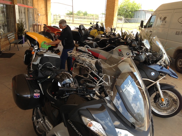
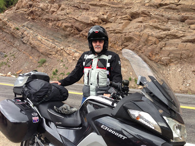
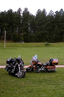
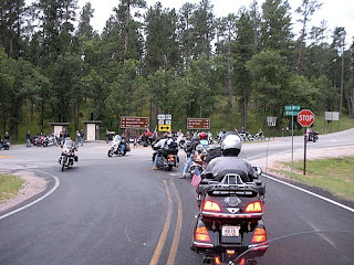
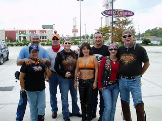
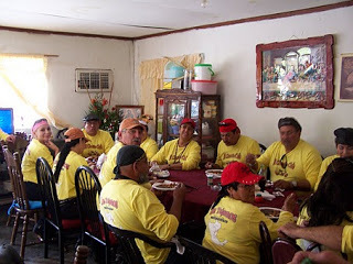
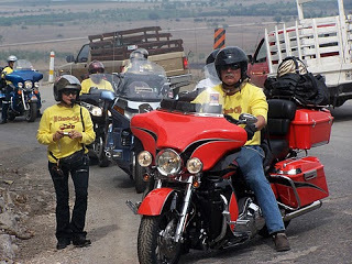
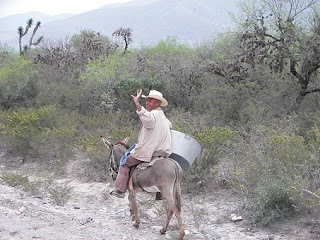
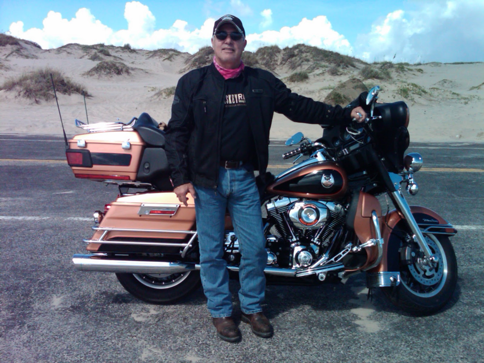
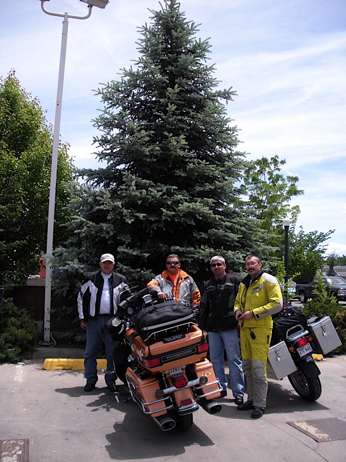
Our ride started in the Rio Grande Valley of South Texas in June at 5:30 am on a typical day in South Texas, a perfect morning soon to get hot. There were five of us riding, Marco Gutierrez a local physician who lives in Edinburg riding a BMW GS, his brother David who flew in from Florida and had his Yamaha at Marco's house ready to ride, Ed Ramirez a computer programmer at the University of Texas at Pan American from Alamo on his 2010 Harley Davidson, my brother Tomas Perez on a Honda ST 1300 and myself riding my 2008 HD Ultra Classic. We decided to avoid the major highways on our trip to Colorado by riding along the less frequently traveled roads or what we call the back way to West Texas. It's a lot quicker ride if you stay on the interstates, Highway 281/37 to San Antonio then I10 West with speed limits at 80 west of Kerrville. Our more pedestrian route first took us to Hebbronville on Hwy 1017 via McCook and San Isidro. From Hebbronville we took Hwy 16 North to Freer before turning northwest on Hwy 44 to Encinal then north on Hwy 83 to Carrizzo Springs and on to Del Rio, 300 plus miles from Mission. It was lunch time and we stopped to eat at Rudy's BBQ.
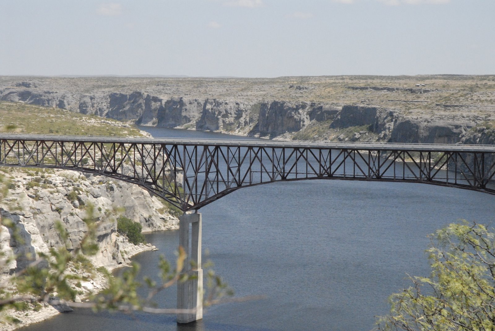
West of Del Rio is the Pecos River and Langtry, home to Judge Roy Bean, Law West of the Pecos fame. The bridge crossing the Pecos is the highest suspended bridge in Texas and it crosses the Pecos right before it merges with the Rio Grande River. We stopped at the Overview park to check out the view of the Pecos River, the bridge and off at a distance to the South the Rio Grande River.
Pecos River
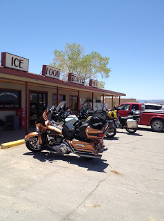
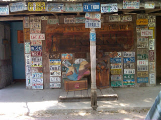
It was over 100 degrees in Langtry, so we stopped at the very nicely built Texas Department of Transportation (TxDot) Travel Information Center. It's home to the historic saloon of Judge Roy Bean and just about every publication at the center is free including complimentary copies of Ride Texas Magazine. Langtry is like an oasis in the desert so it's worth the stop.
TxDot Information Center
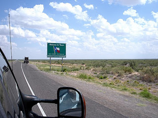
On the road again, its now hot enough to make you think about how great tires are that they can roll mile after mile on pavement that's got to be at least 115 degrees without melting. You don't think about that in a car, but it sure crosses your mind on a motorcycle. Being partial to a tire manufacturer dedicated to motorcycle tires, I run with 
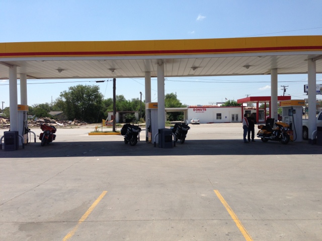
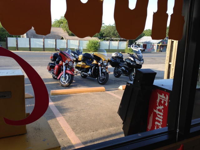
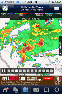
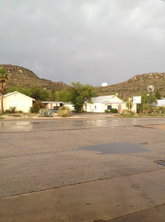
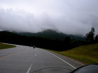
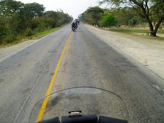
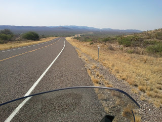
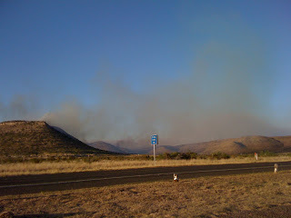
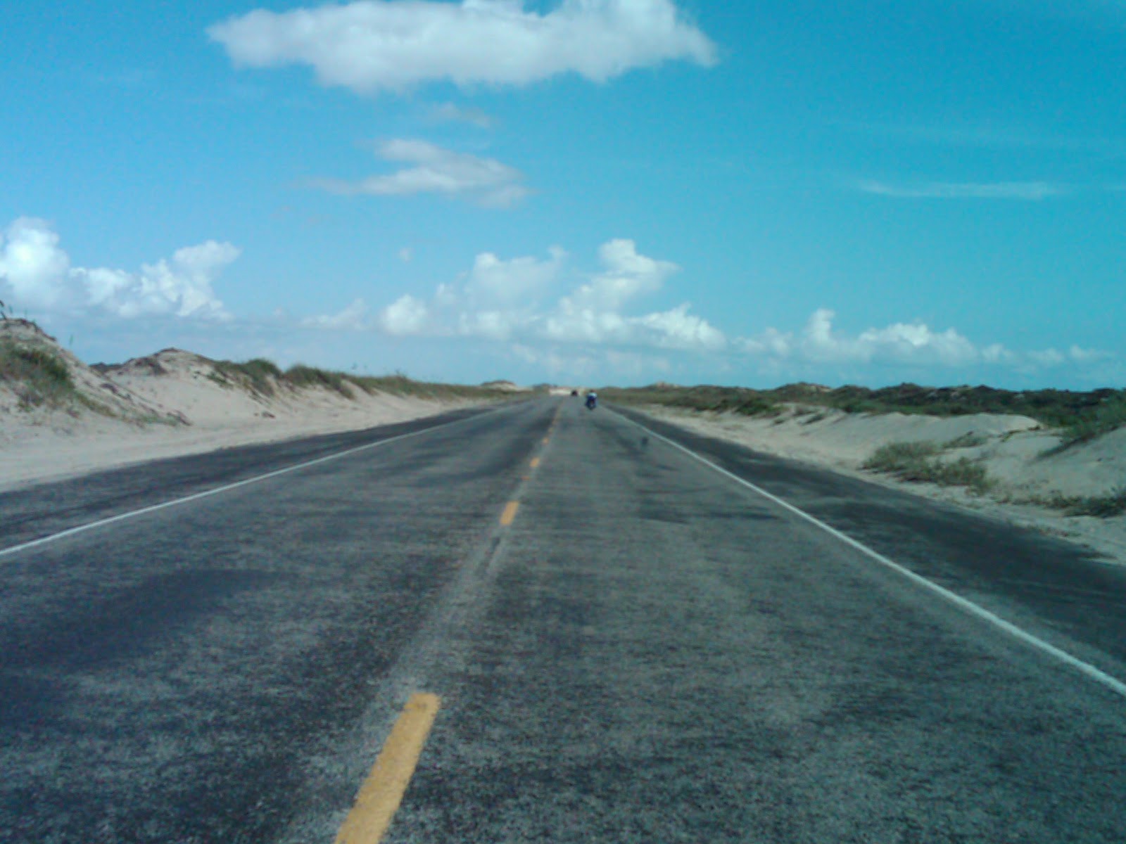
Metzeler and like their grip in the rain. We continued west along Hwy 90 to Sanderson, a town with two noteworthy gas stations. There's a popular big gas stop at the western end of town and on the east end of town a small gas station with a shaded picnic table that makes for a good soda break. I'm not sure why Sanderson is out there, maybe because of the intersection on Highway 285? It's this highway which we took as we headed 65 miles northwest to Fort Stockton. Fort Stockton is on I10W so it gets traffic running between El Paso and San Antonio especially truck traffic. We crossed Fort Stockton still headed northwest toward Pecos, another 55 mile jog. Pecos is usually very hot and dry, but we were lucky to hit a thunderstorm as we rode into town. The welcome rain cools us off for the rest of the day. Pecos is not suited to handle much rain and the streets were quick to flood. We weren't far from the Land of Enchantment, New Mexico so we pushed on. It was getting late in the afternoon so temperatures started to cool off as we entered New Mexico. There's a dramatic drop in speed limits going from Texas to New Mexico from 75mph to about 60mph. That's pretty unbearable on roads with little or no traffic so we ride at a conservative 73mph as the GPS reads. We rode past Carlsbad as the sun set and stopped for the first night close to Lakewood at a local KOA Campground. It was a good first day's ride, approximately 742 miles, and ready for dinner.
KOA Camp North of Carlsbad, NM

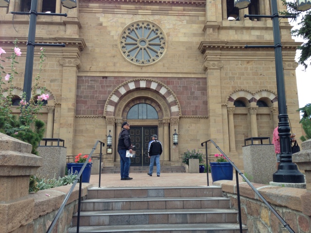
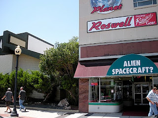
Day two was a much cooler day. We took some back roads toward Roswell where we stopped for breakfast at Denny's. Western New Mexico is fairly flat and the winds can really blow. We rode through some strong cross winds and luckily squeaked through threatening thunderstorm clouds that made the storms back in Pecos look like a spring shower. Traveling northwest we stopped for a couple of hours in downtown Santa Fe. We had a light lunch at the French Pastry Shop & Creperie by the plaza. They have great pastries and good coffee, a must stop if you're in the area.
Downtown Santa Fe near French Pastry Shop

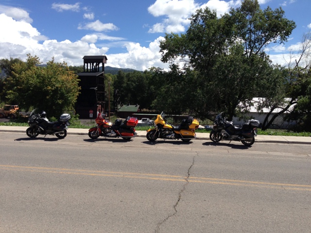
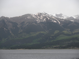
We continued our ride through Santa Fe and headed north toward Pagosa Springs, CO and the San Juan National Forest. Cross into Colorado and the landscape turns emerald green a sharp contrast from the desert sands of West Texas and New Mexico. From Pagosa Springs we headed west to Durango and ending our second riding day. We had crossed the entire state of New Mexico, an easy 500 mile day compared to our first day's ride.
Close to Pagosa Springs, Colorado

Durango, Colorado is home to the Narrow Gauge Railroad that runs between that town and Silverton. It's a popular ride and one I had taken many years ago when my kids were younger. The scenic ride meanders through the mountain passes to Silverton.
Silverton, CO
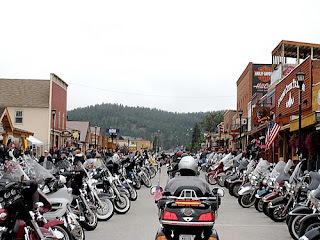
Silverton, the only scheduled stop, offers enough time for shopping and lunch before heading back to Durango.
We stayed at the Holiday Inn Express and got a late start because I wanted to wait for the local Harley Davidson shop to open so I could buy a heated vest. Seems I packed long sleeve shirts, but not nearly enough warm clothes for the upcoming days. We would experience temperatures as low as 36 degrees on our trip, a dramatic difference from the weather in Langtry! Finally, late that morning we rode west to 
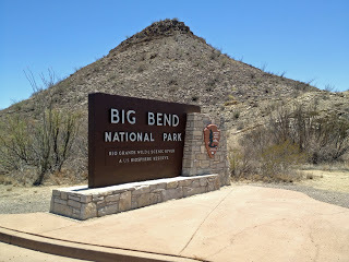
Mesa Verde National Park. The cliff dwellings of the Pueblo people date back to 600AD and it's good ride. The terrain flatten out as you go west and things warm up a bit.
Mesa Verde National Park
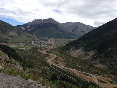
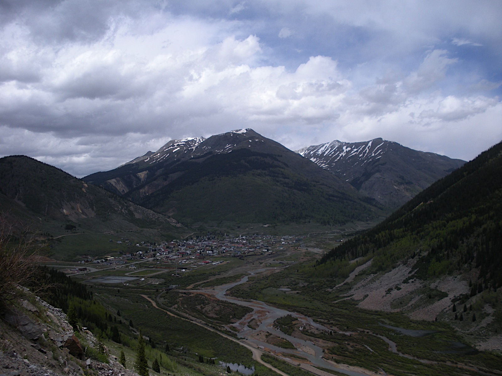
We backtracked to Durango and headed north to Silverton then Ouray.
Ouray is known to some winter tourists that visit us in South Texas as the little Switzerland of the USA. Having never been in Switzerland I have no clue as to the truth of that statement. Ouray is nestled between some fairly big mountains leaving you the sensation of being in a bowl.
We continued north to Montrose, but decided to double-back south to find Ridgway State Park near Ridgway where we wanted to camp for the night.
Ouray the little Swiss Town
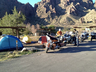
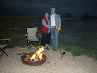
We pitched our tents, made a fire, and chatted into the night before getting into our sleeping bags. It was 46 degrees that night so our sleeping bags were perfect for a cool night. I've always camped with our Marmot sleeping bags rated at 30 degrees and our Comet two person tent from Sierra Designs. The Comet has extra strength poles for those windy nights. Both of these come from REI online orders.
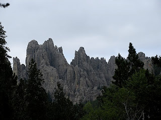
Ridgway State Park is rated as one of the top ten state parks in the United States. If you walk to the top of a small hill there's a beautiful view of an adjoining lake. We had two campsites, but decided to group our three tents on one site and got in trouble for that. We used one site to park the bikes and another to camp, but park rules limit the number of tents to two per site. Who knew?
Black Canyon
Marco Gutierrez at Black Canyon
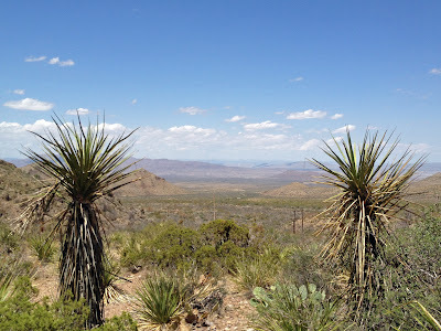
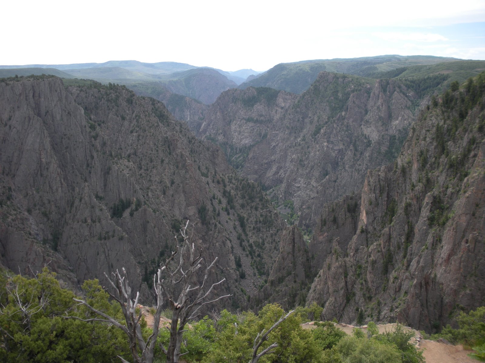
The Park Rangers at Ridway State Park, yes, the same ones that got after us for too many tents on one site were very good in offering us travel recommendations. They recommended we stop at the Black Canyon mentioning that most people don't even realize its there and its often overlooked even though its a great place to visit. We took their advice and headed in that direction. We had an early brunch in Montrose before heading to the Black Canyon of the Gunnison National Park then back on the road headed east toward Gunnison.
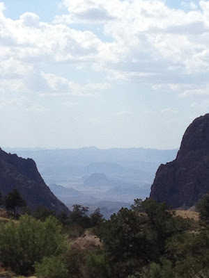
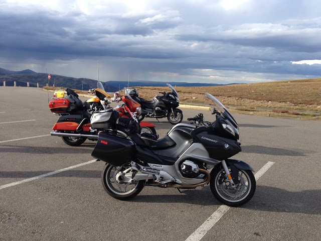
Riding into those mountains as we head to Aspen
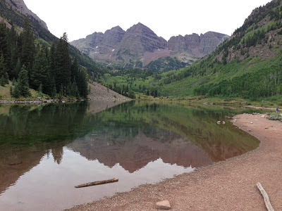
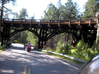
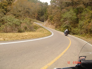
We rode Hwy 50 east to Poncha Springs then north on 285 to Buena Vista. North of Buena Vista we caught Hwy 82 and headed northwest to Aspen. Highway 82 is a narrow two lane road that eventually makes its way to Aspen. The weather was overcast and threading to rain, but we made it safely to Aspen. After walking some of the downtown streets in Aspen we decided that it's not for us so we ride on.
Next came Carbondale then Glenwood Springs before getting on I70E and headed to Vail. We stopped for the night at one of the many hotels on I70.
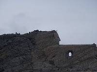
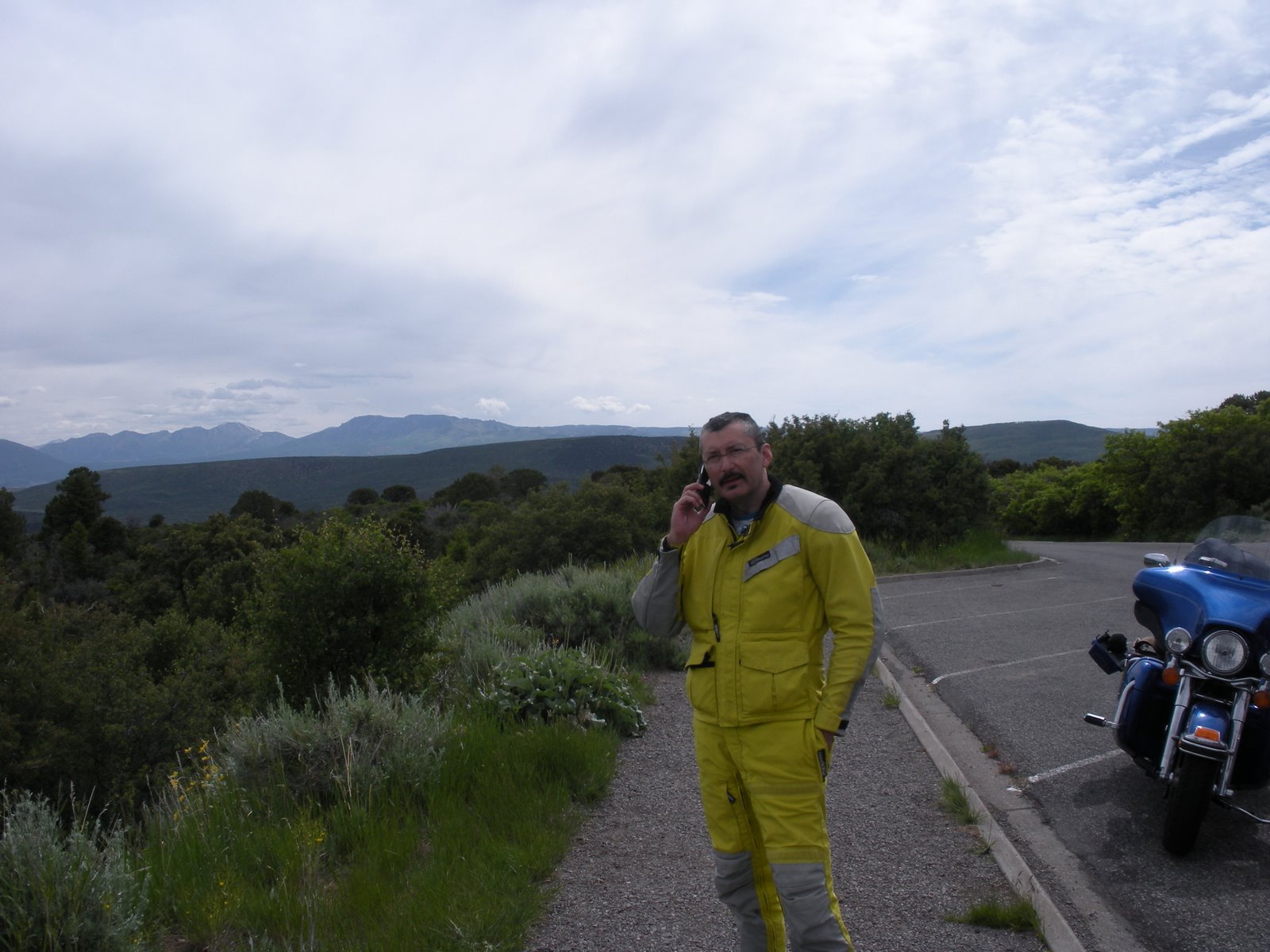
The next morning we continued on I70E headed for the base city of Mount Evans, Idaho Springs which is about 45 minutes west of Denver. Idaho Springs was a welcome site, unlike Aspen or Vail, this town had regular stores and restaurants and just regular working class people. We had been on I70 with typical traffic congestion, but still a beautiful ride as expressways go. After a short break in Idaho Springs we started on Hwy 103 to Echo Lake. Echo Lake has a nice gift shop and restaurant and I don't know if its best to stop there on the way up or on the way down, but I would recommend making that stop on the way down. Weather changes can be sudden and dramatic especially in the late afternoons so it's best to get the ride out of the way before it gets too late. On the way down the Echo Lake stop seems like you're safe again, so stop and get those bumper stickers that say you made it to the top of Mt. Evans. On the way up those decals seem expense, but on the way down they seem like a real bargain.
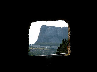
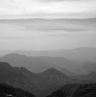
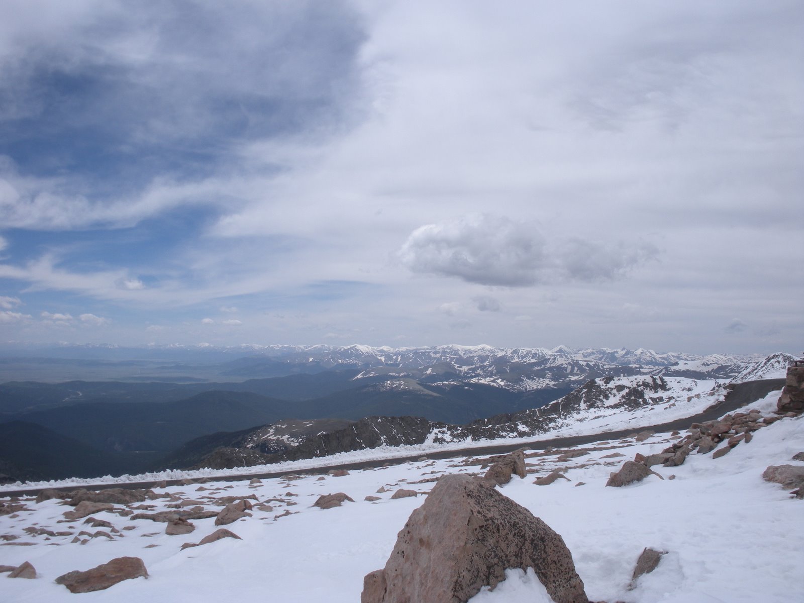
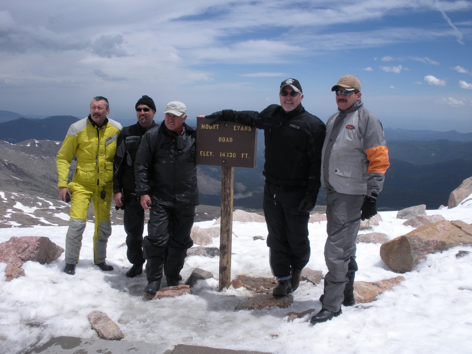
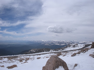
We started our climb about noon with clear skies. It had been in the 70s down at Idaho Springs, but it was now getting cooler. Just beyond the Echo Lake stop is the official park entrance. An entry fee of about $10 is required. The park road is very different than the highway leading up to Echo Lake. It's much more narrow and the tall forest trees are much closer to the road than down below. The road has a steady climb, the terrain slowly giving way to less trees and suddenly you are above the tree line. Being scared of heights made me tighten the grip on my handlebars, focus on the road and not on the sheer drop-off just a few feet away, and a fixation on my Garmin GPS's altitude gauge. I knew that the switch-backs would end at 14,130 feet so I kept glancing at the GPS wondering if it was really right. The switch-backs literally make 180 degree turns. Keeping the bike upright as you navigate each turn was a challenge. The altitude displaying on my GPS was moving fast, but to me it seemed too slow for me. After every turn around the bend there was more road in front of us, always leading up. Eventually we could see the lookout building and knew we were making it all the way to the top. The temperature was now between 36 and 39 degrees. It was difficult to breath and my heart was really pumping. I think its natural to breath more rapidly to get more oxygen in your lungs. I was wrong and realized that when I read the informational sign telling you to stay calm.
View from top of the highest paved road in North America!
Knowing what lay before us, the ride back down the mountain was very welcome. We could relax and enjoy the view knowing that every turn got us back closer to planet earth.
Once we were back at Idaho Springs we made our way West on I70 and turned north on Highway 40 heading to Grandby. We took the Trail Ridge Road 34 across the Rocky Mountain National Park to Estes Park. The Trail Ridge Road was another high altitude adventure as we crossed the Continental Divide again on our crisscrossing ride in Colorado. Of course, this road was tame compared to the Mt. Evans adventure and the inclines on the cobblestone roads of Real de Catorce in Mexico. Rocky Mountain National Park gets over three million visitors a year and I can understand why as you travel the Ridge Road you will see wildlife like huge elk, green meadows in panoramic views below your road elevation, and snow in the summer. Estes Park is another great park that serves as the East entrance to the national park. It makes for a great camp base before heading into the national park.
We spent our last night in Colorado on the outskirts of Boulder and so ended our rocky mountain ride. We headed out of Colorado via Hwy I70E across the eastern part of Colorado. As we headed east we made Salina in Kansas then south to Wichita and pressed on to Oklahoma City. It was a long day's ride logging over 700 miles. The next day we duplicated our miles by doing another 700 plus mile ride home from Oklahoma City to Mission, Texas. By the time we hit the Texas state line we were back in hot weather and our heavy jackets and electric vests were somewhere deep in our saddle bags by then.
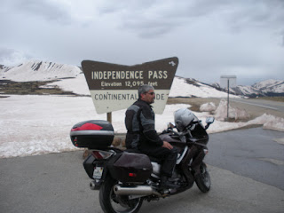
David Gutierrez at Independence Pass - 12,095 Feet

Road leading to summit
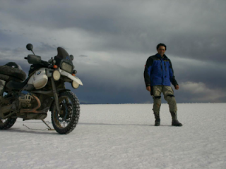
We rode over 3,200 miles on our trip and crossed West Texas, New Mexico, Colorado, Kansas, Oklahoma and Texas again, but north to south. We averaged about 500 miles a day at speeds between 80 and 5mph. We weathered temperature changes from 100 degrees to close to freezing, crossed the Continental Divide, camped out, visited several National Parks and got to see the great outdoors.
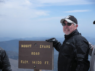
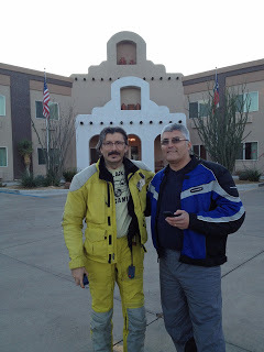
Yep, we're at 14,130 feet!

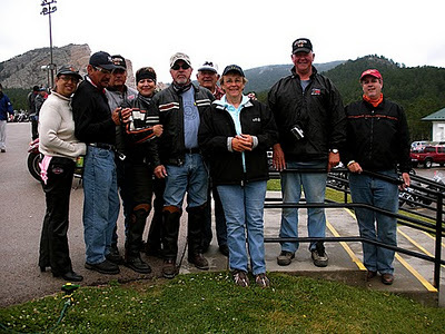
Tomas, Ed, David, & Marco


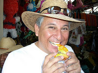
Marco Gutierrez, David Gutierrez, Tomas Perez, Ricardo Perez, Ed Ramirez
Summit 14,130'


View Mt. Evans Colorado in a larger map